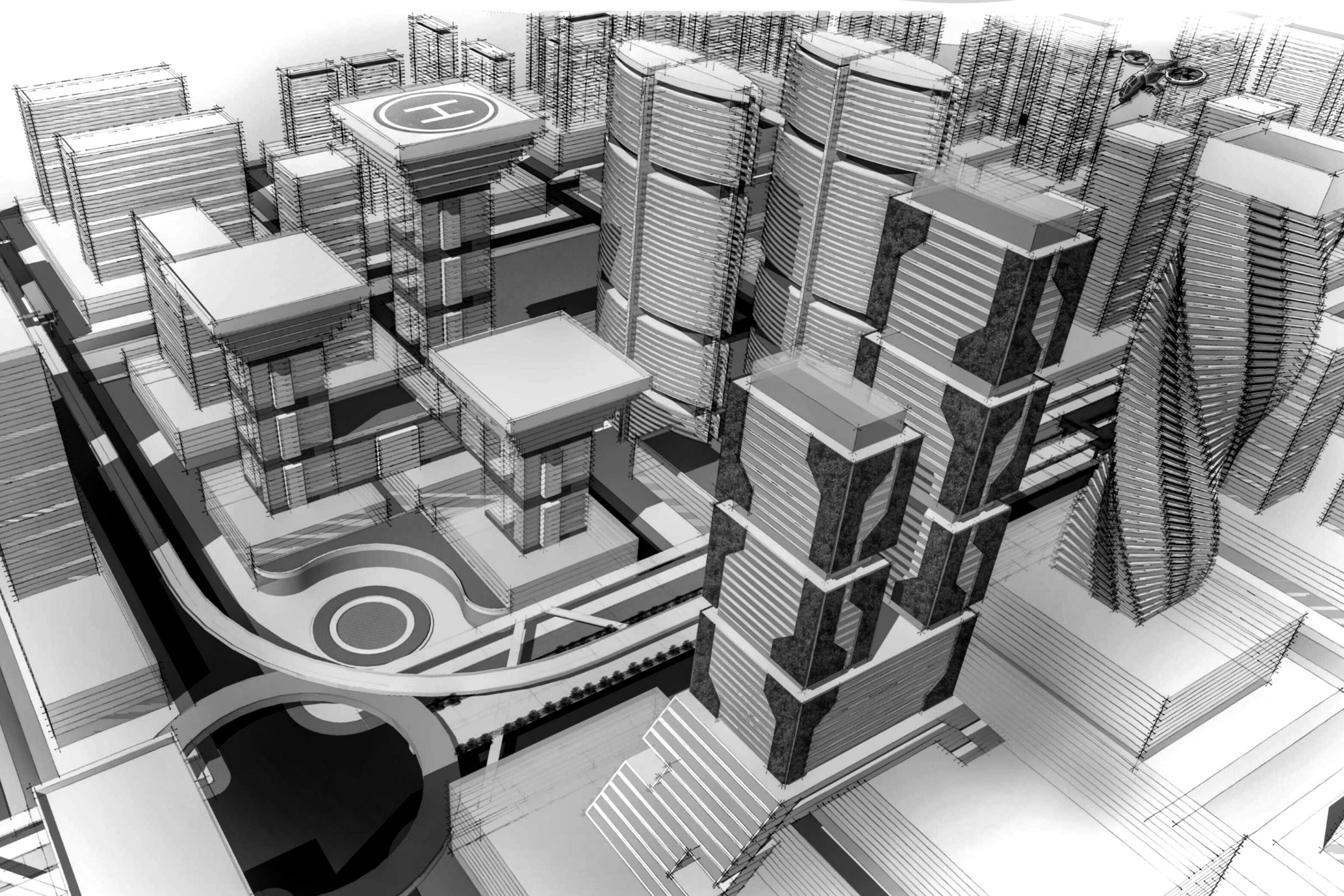
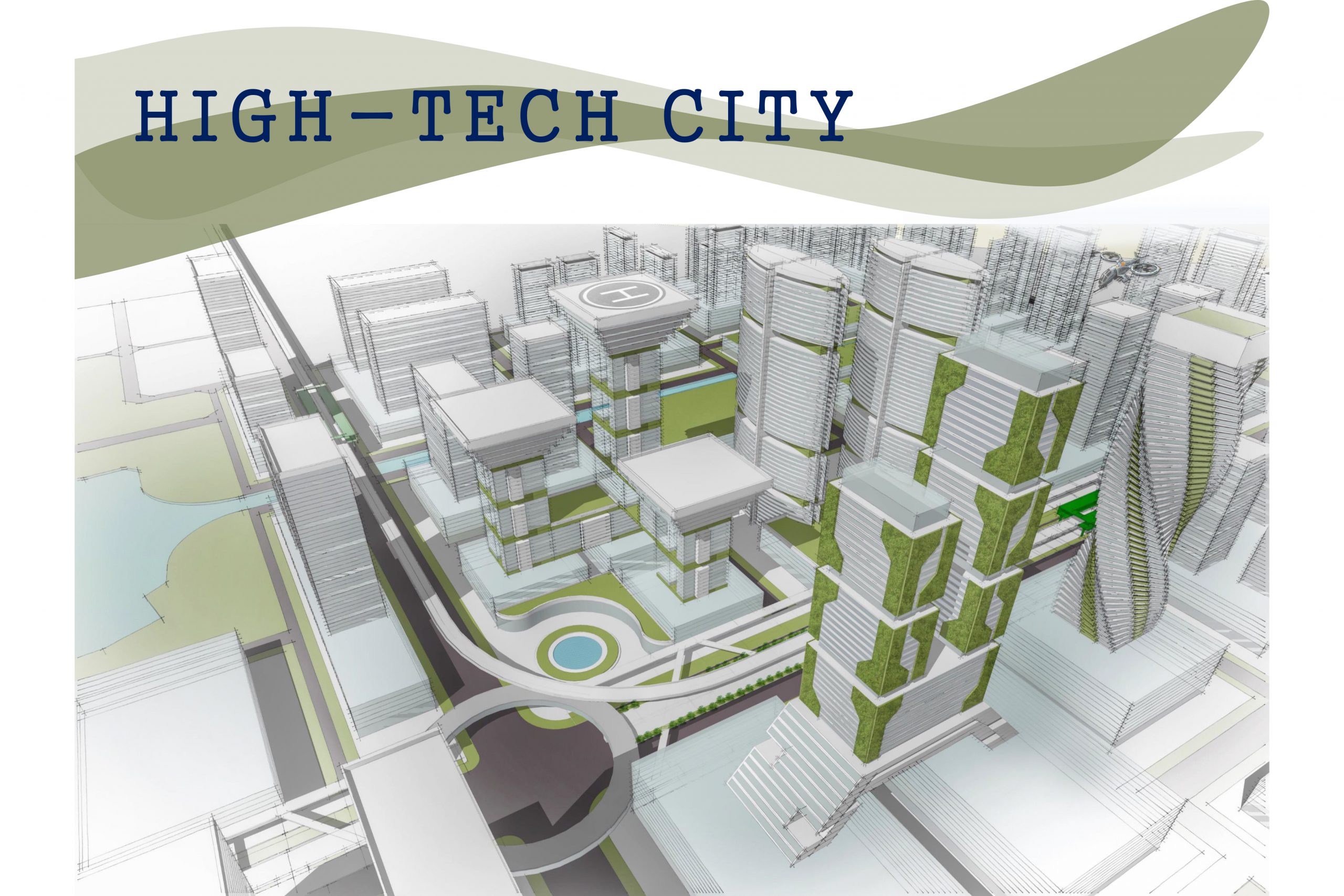
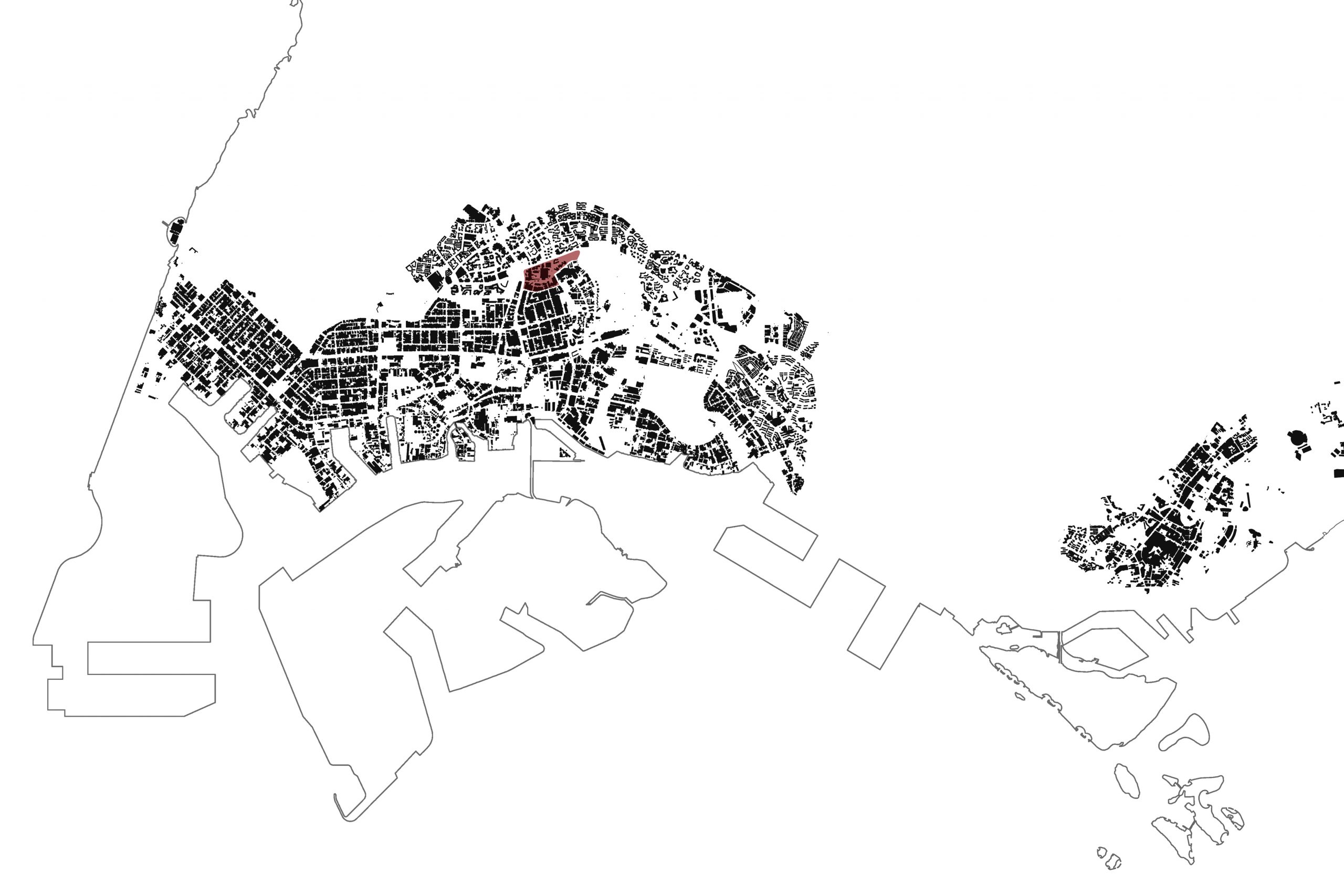
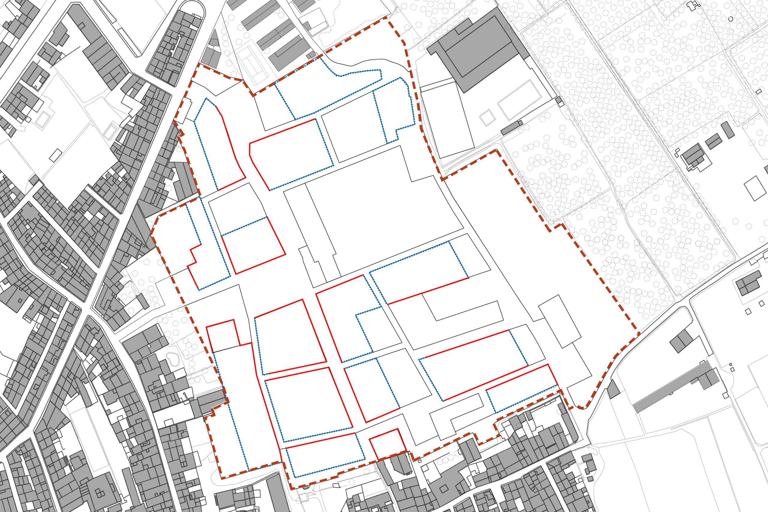
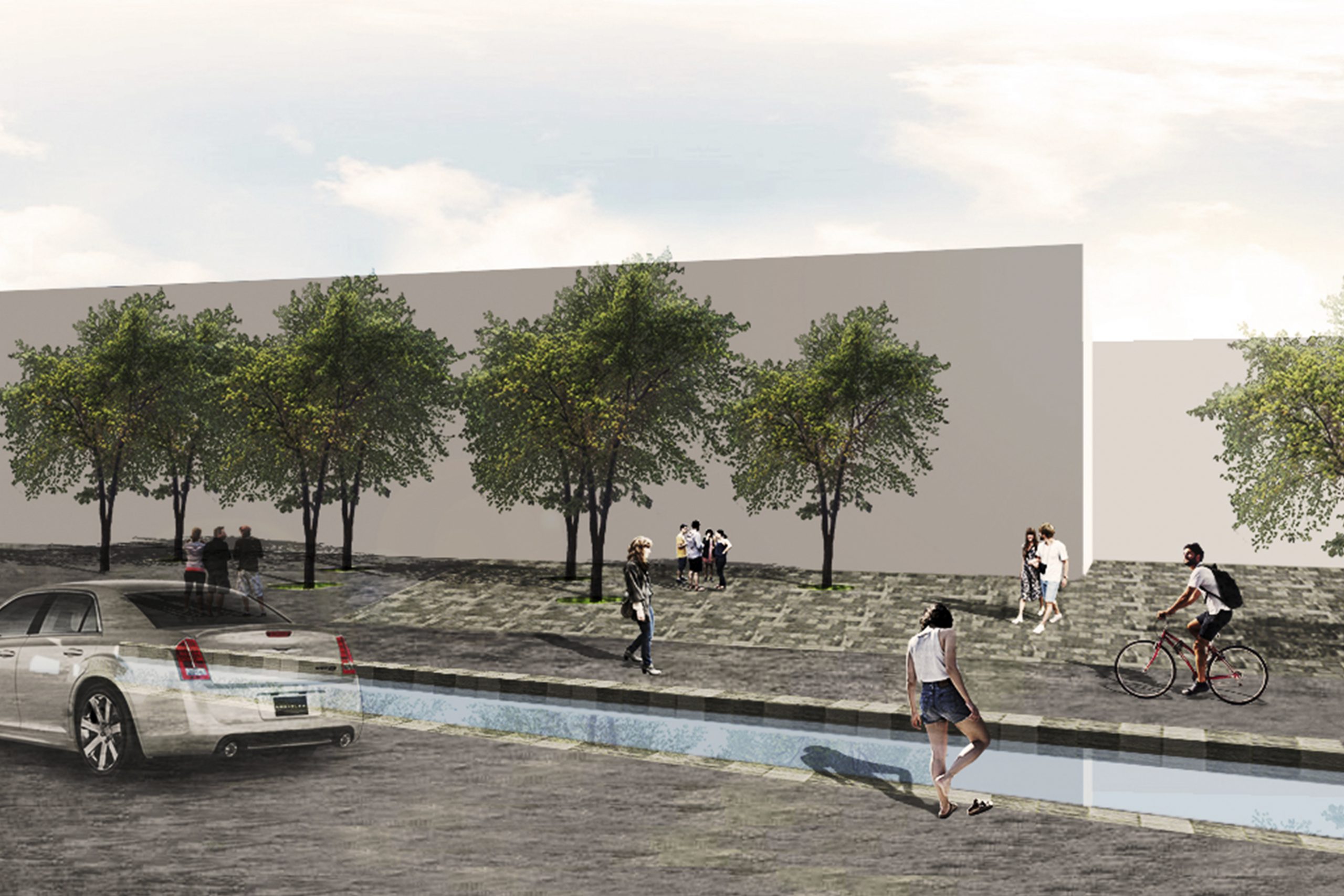
High-tech city
PROJECT INFORMATION
Location: Jurong, Singapore
Scale: 800000 m2
Software: AutoCAD, Photoshop, Illustrator, SketchUP
DESCRIPTION
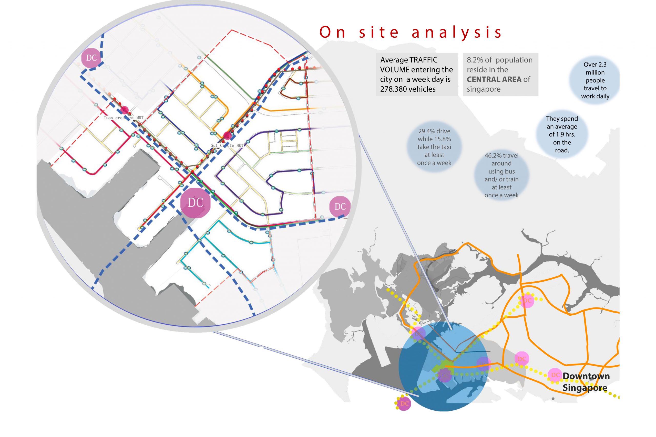
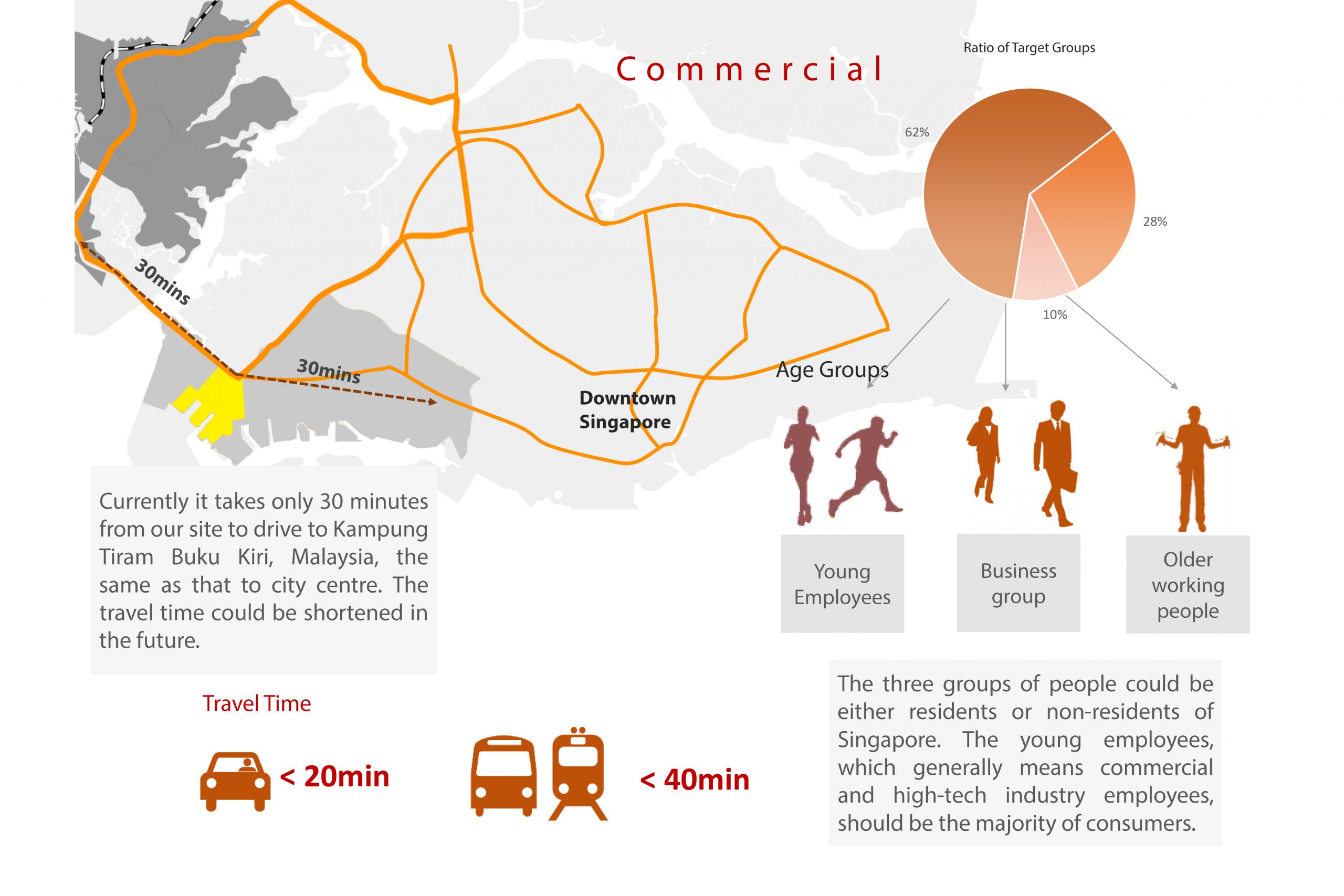
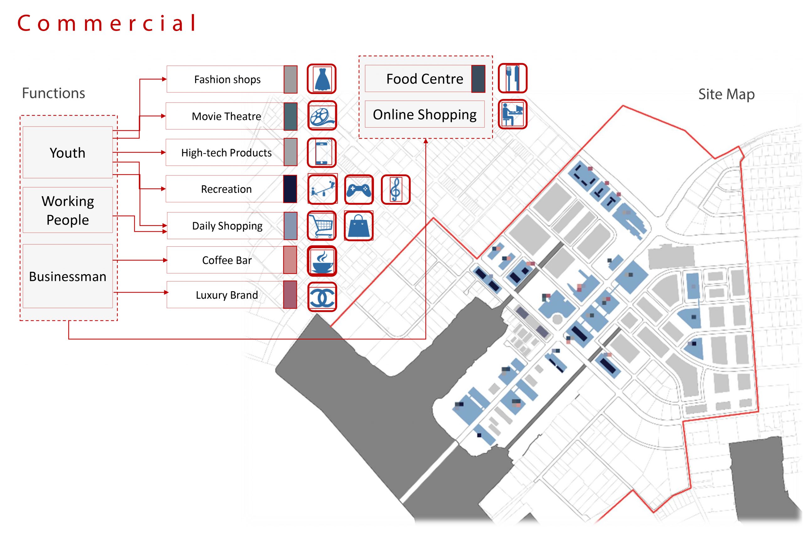
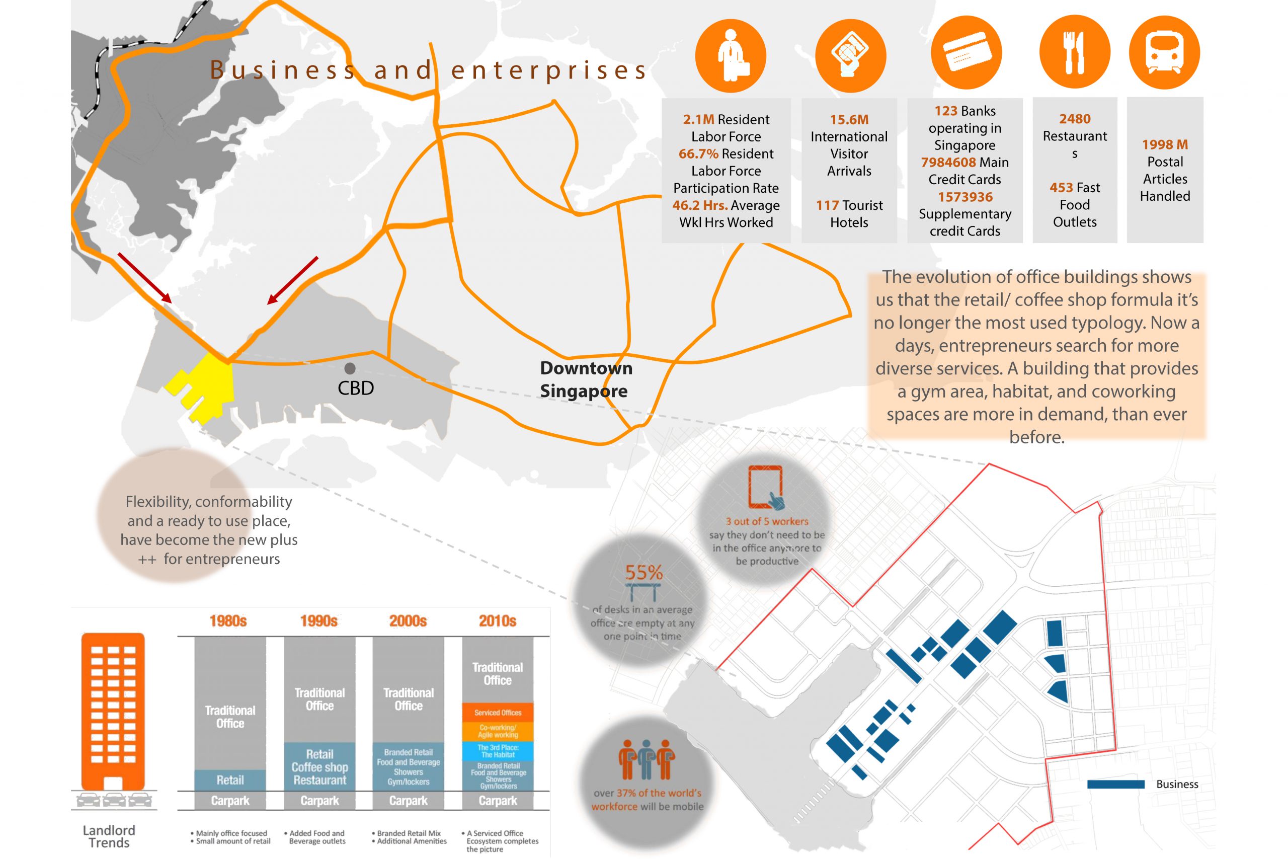
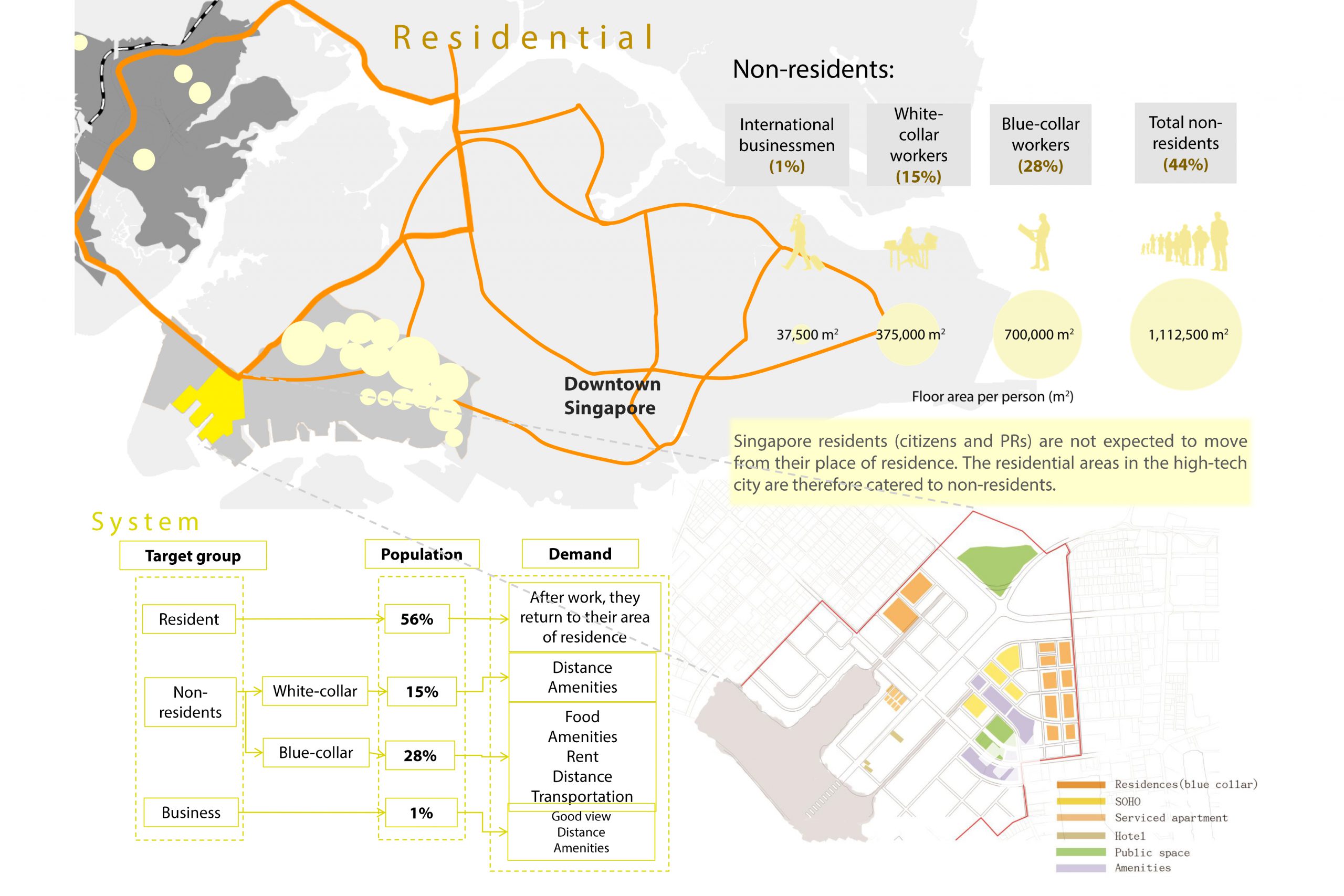
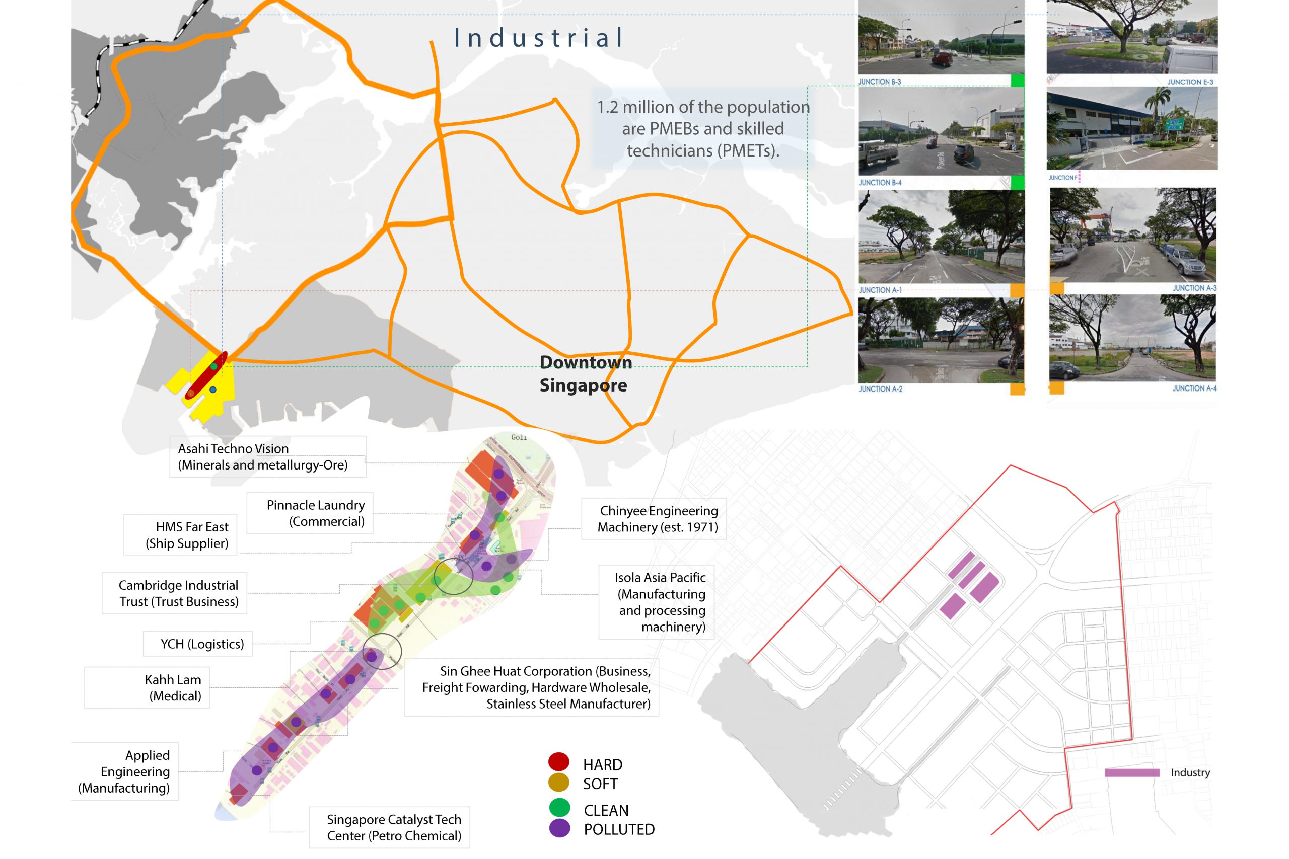
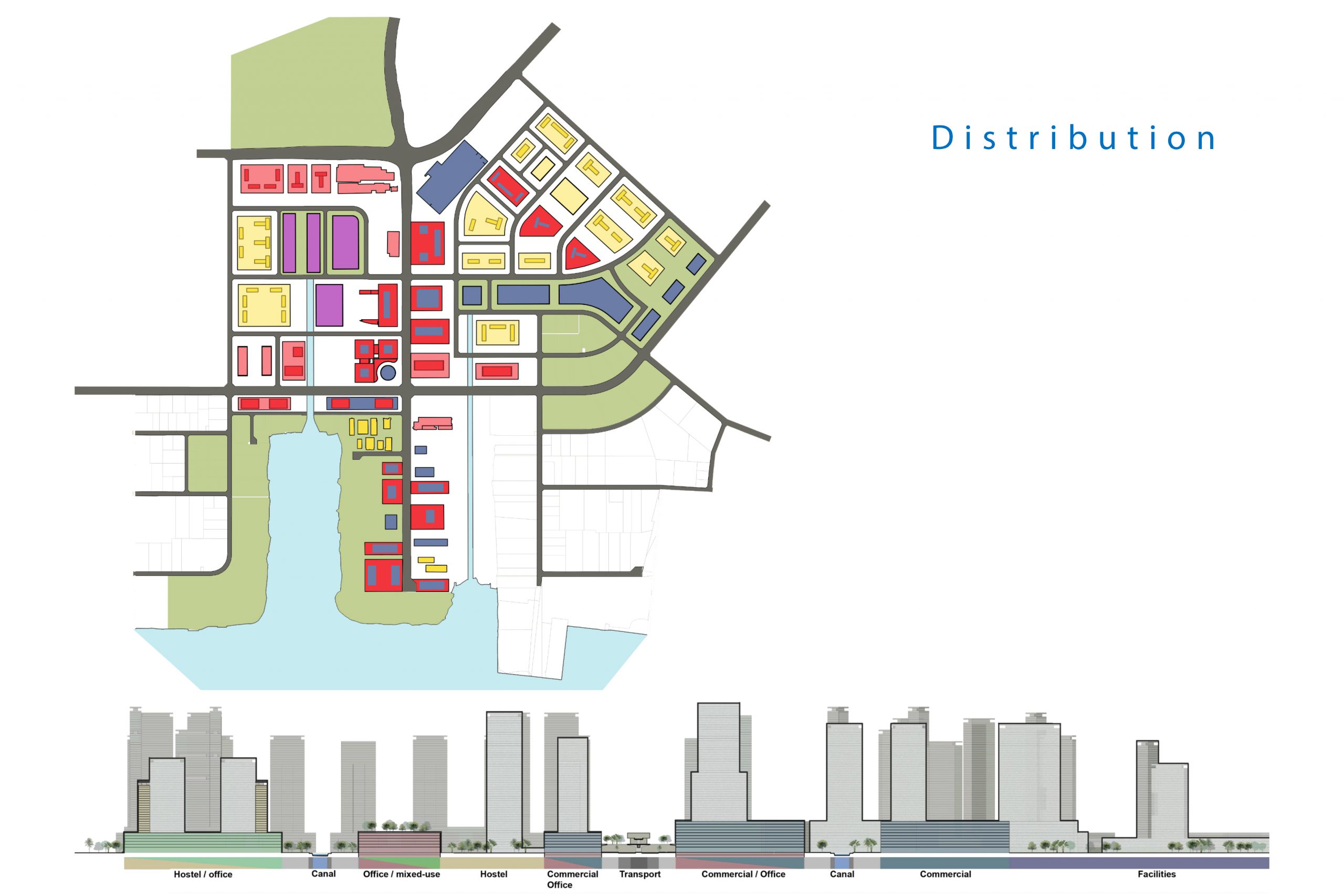
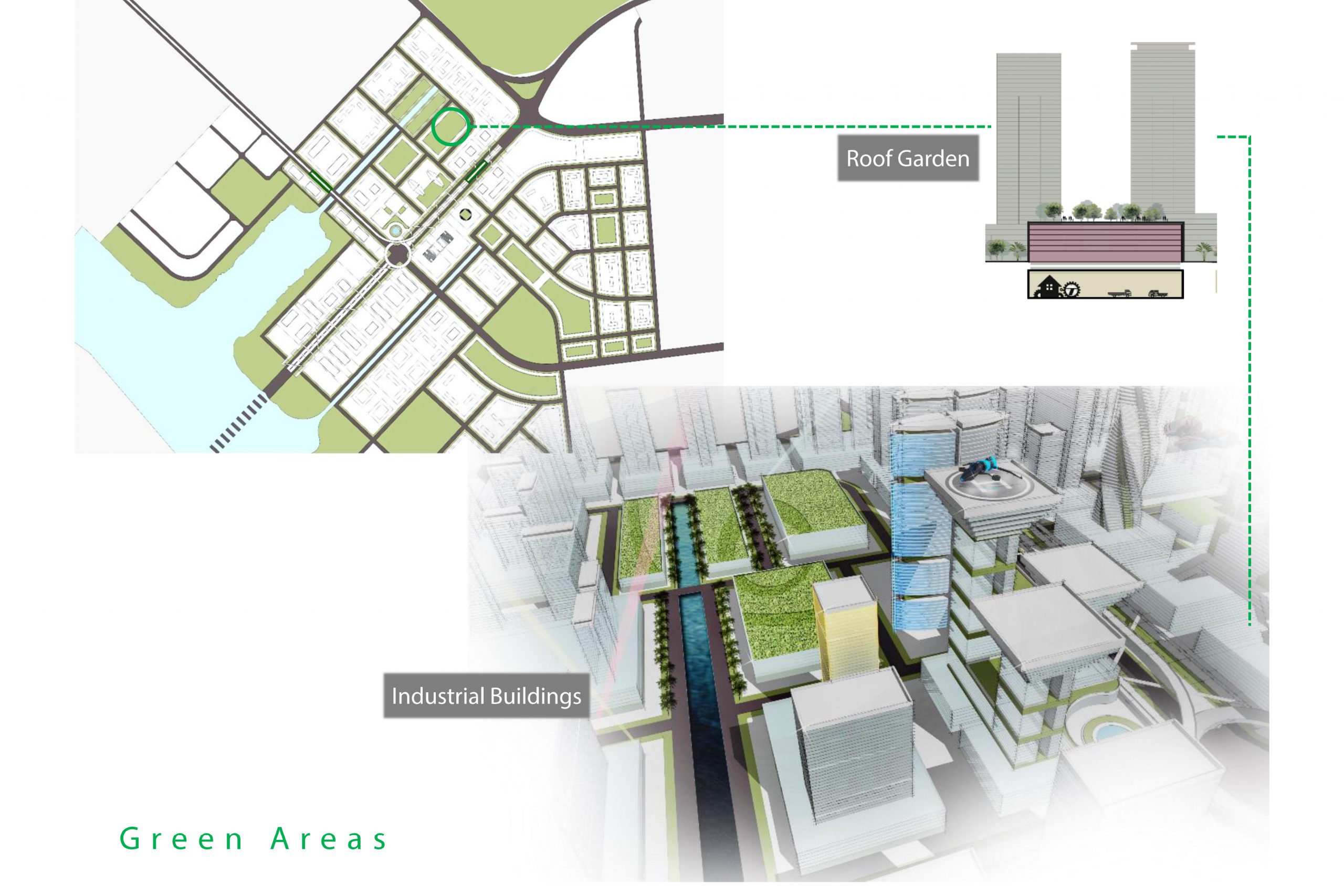
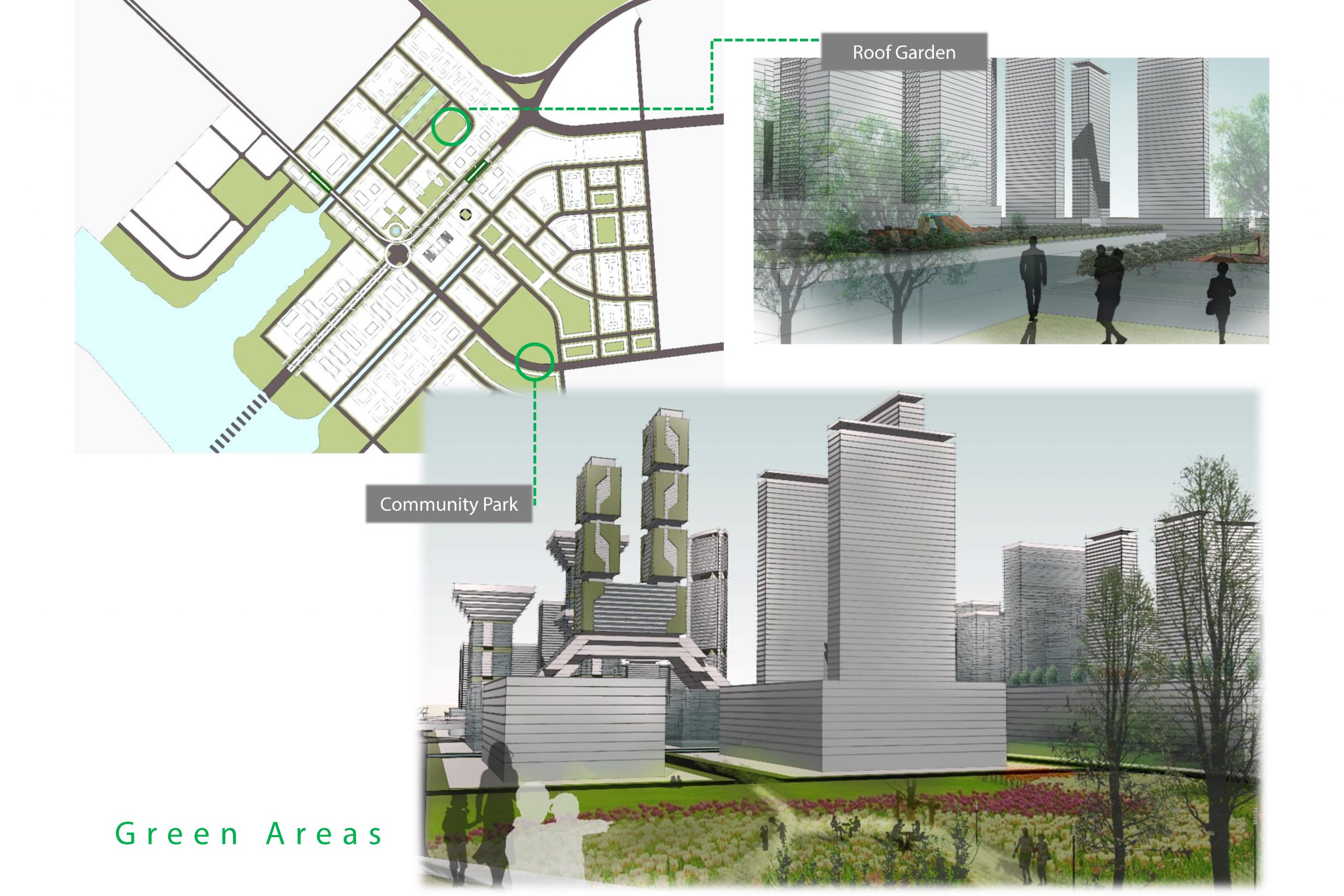
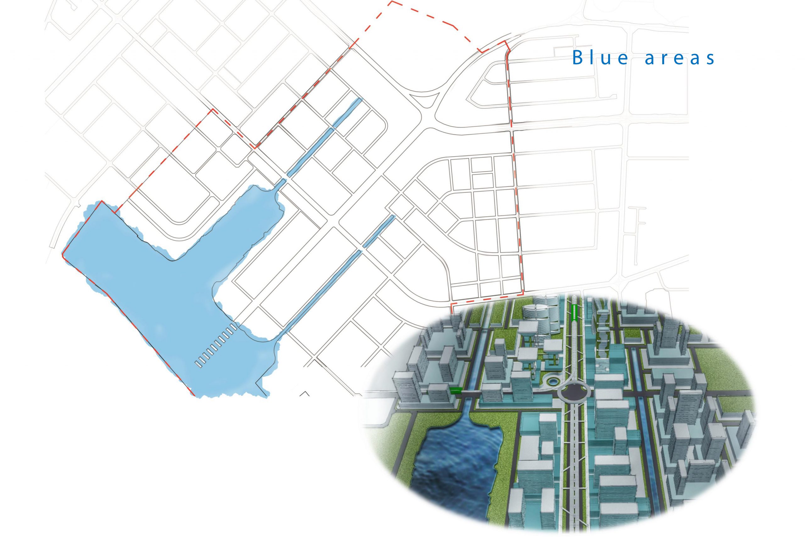
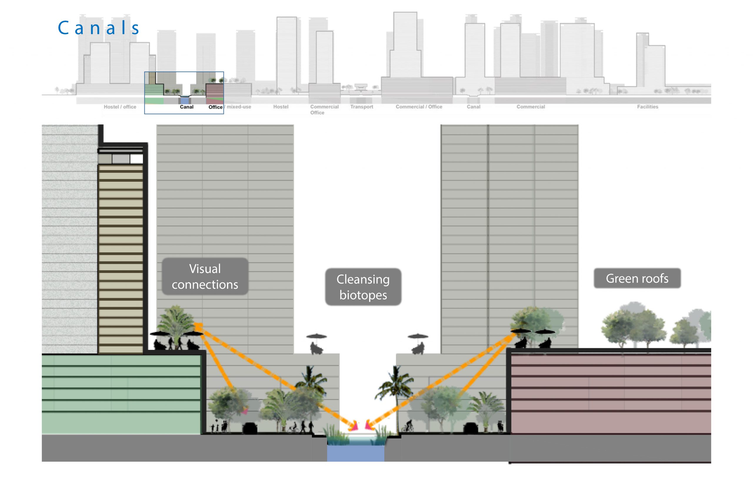
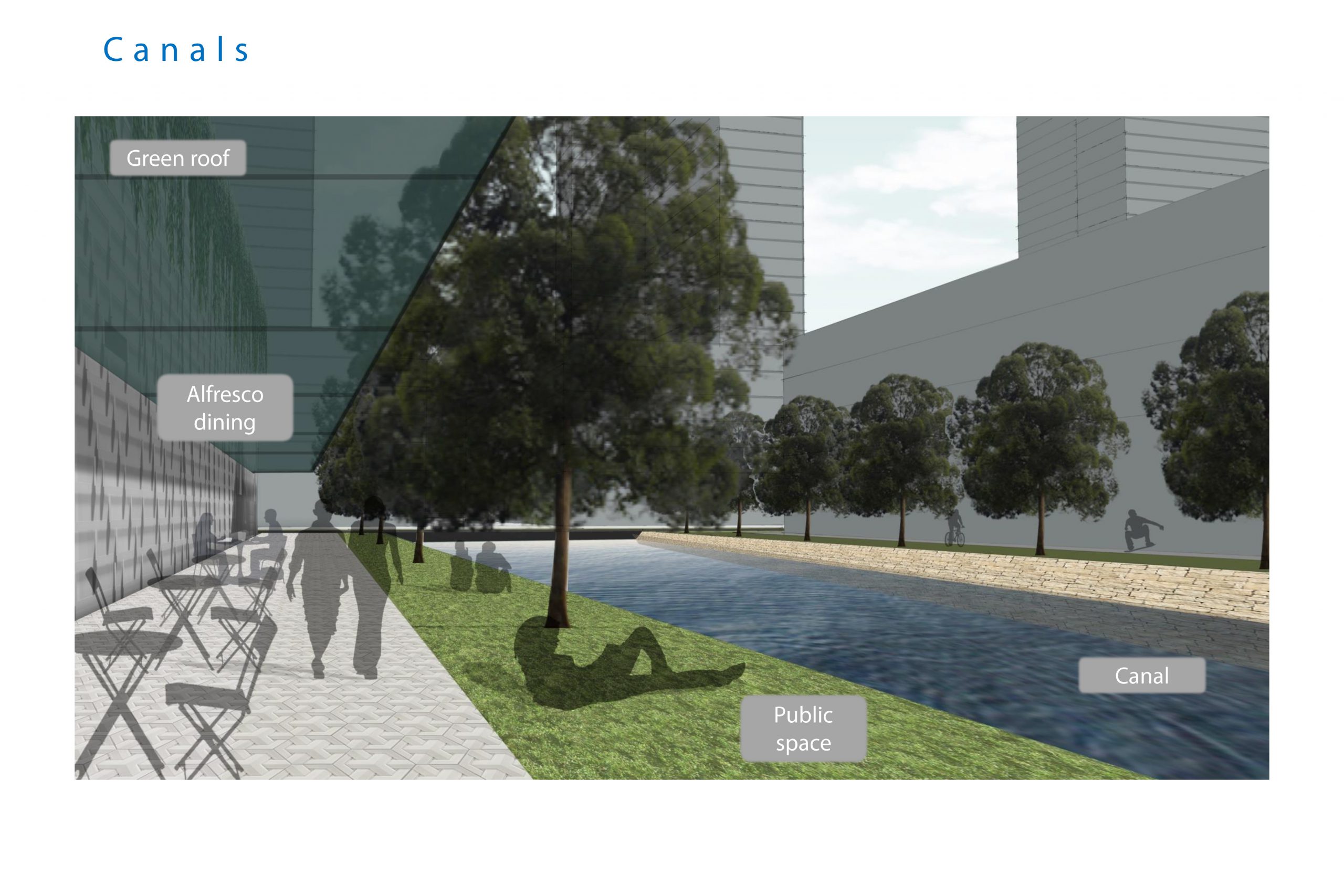
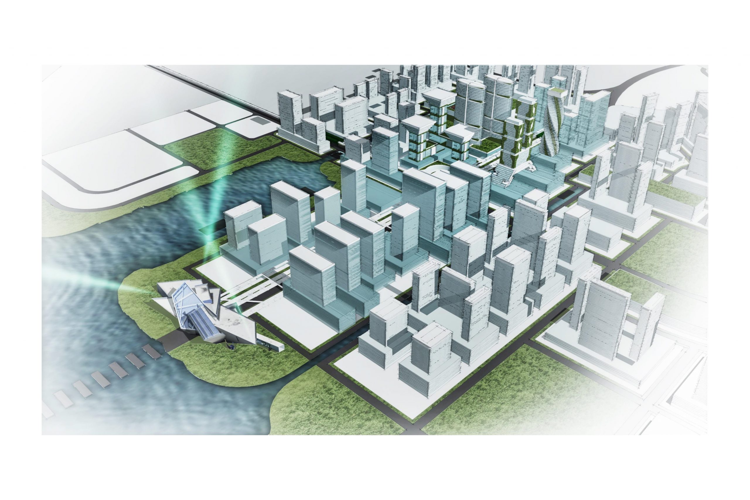
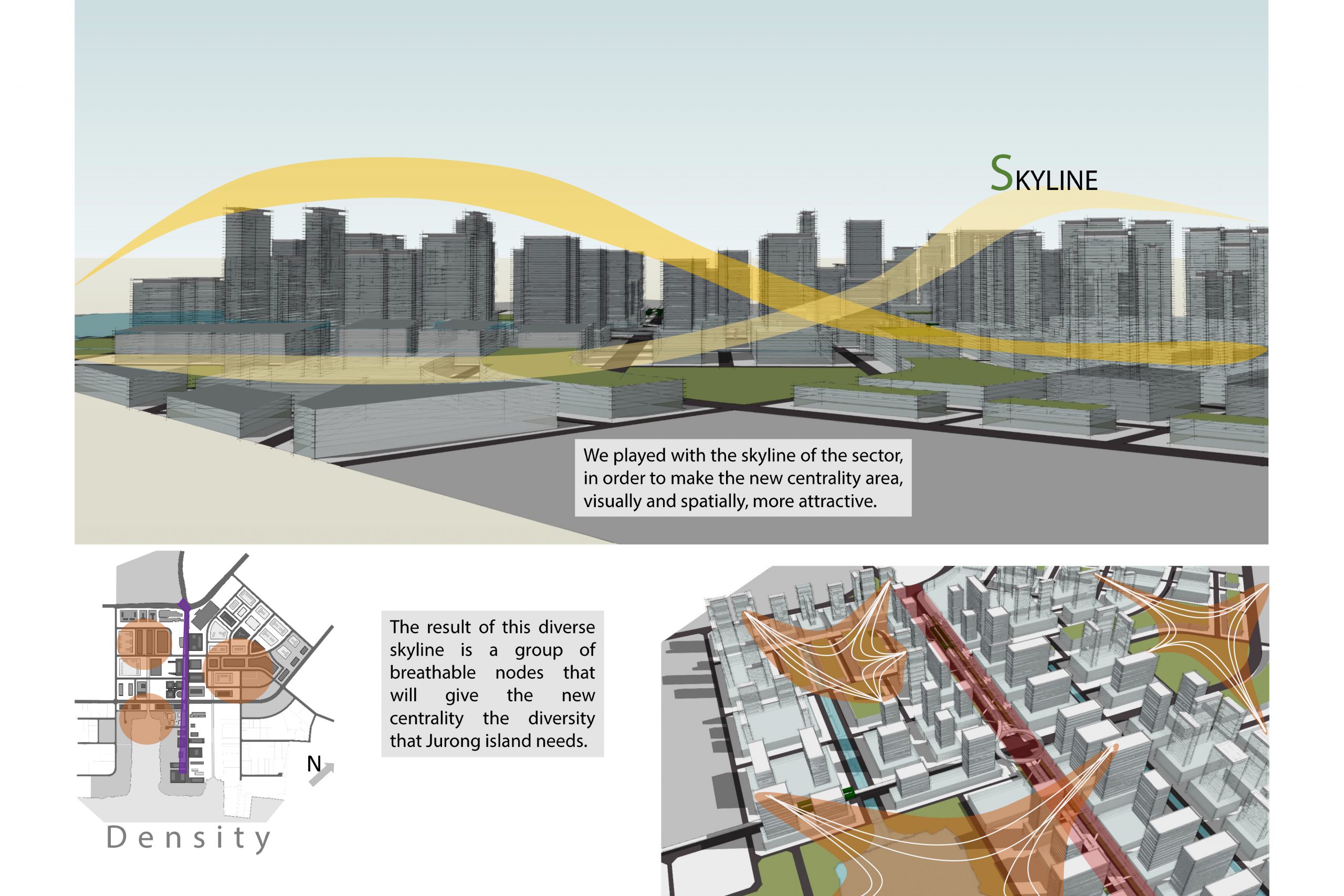
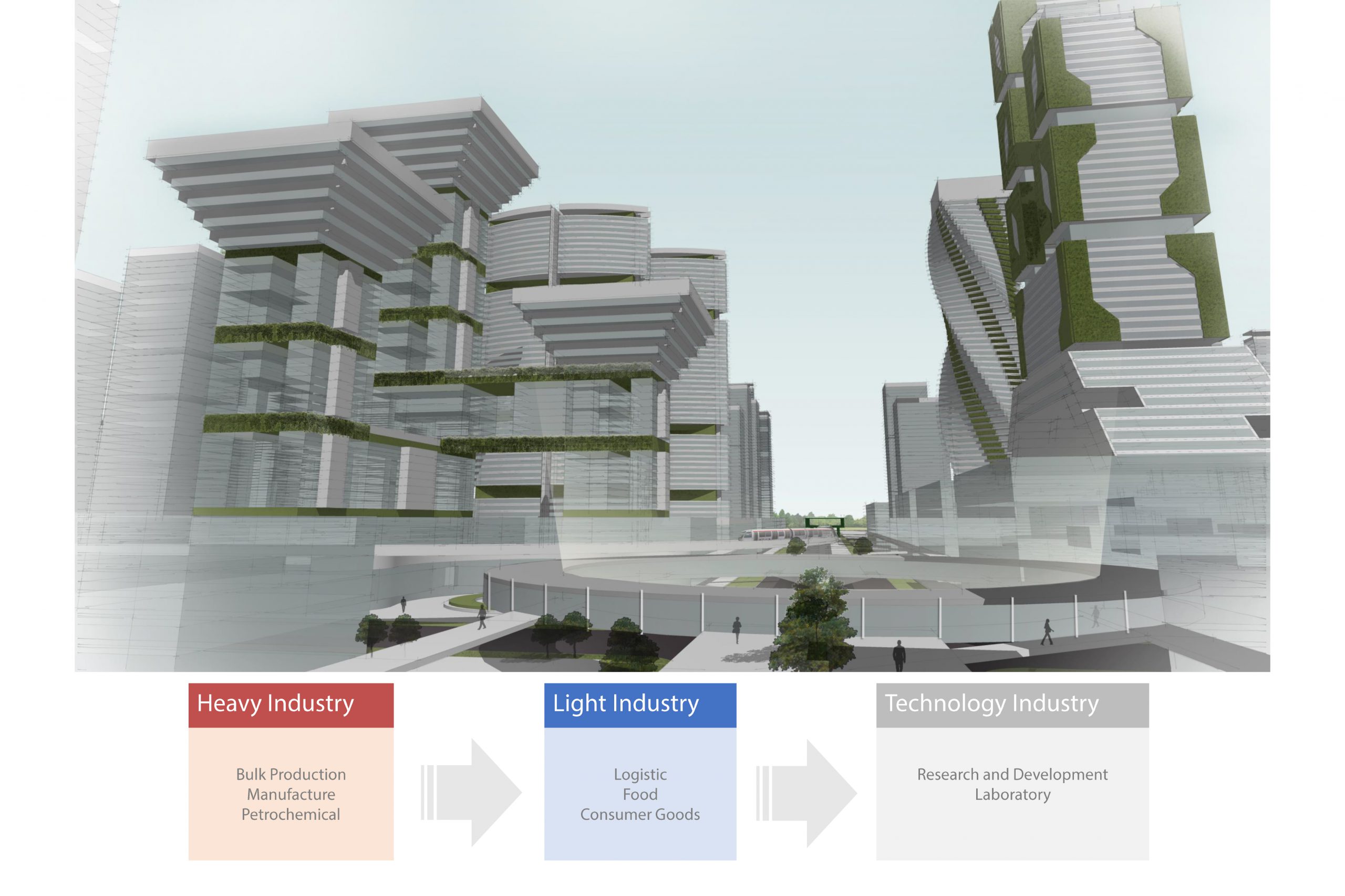
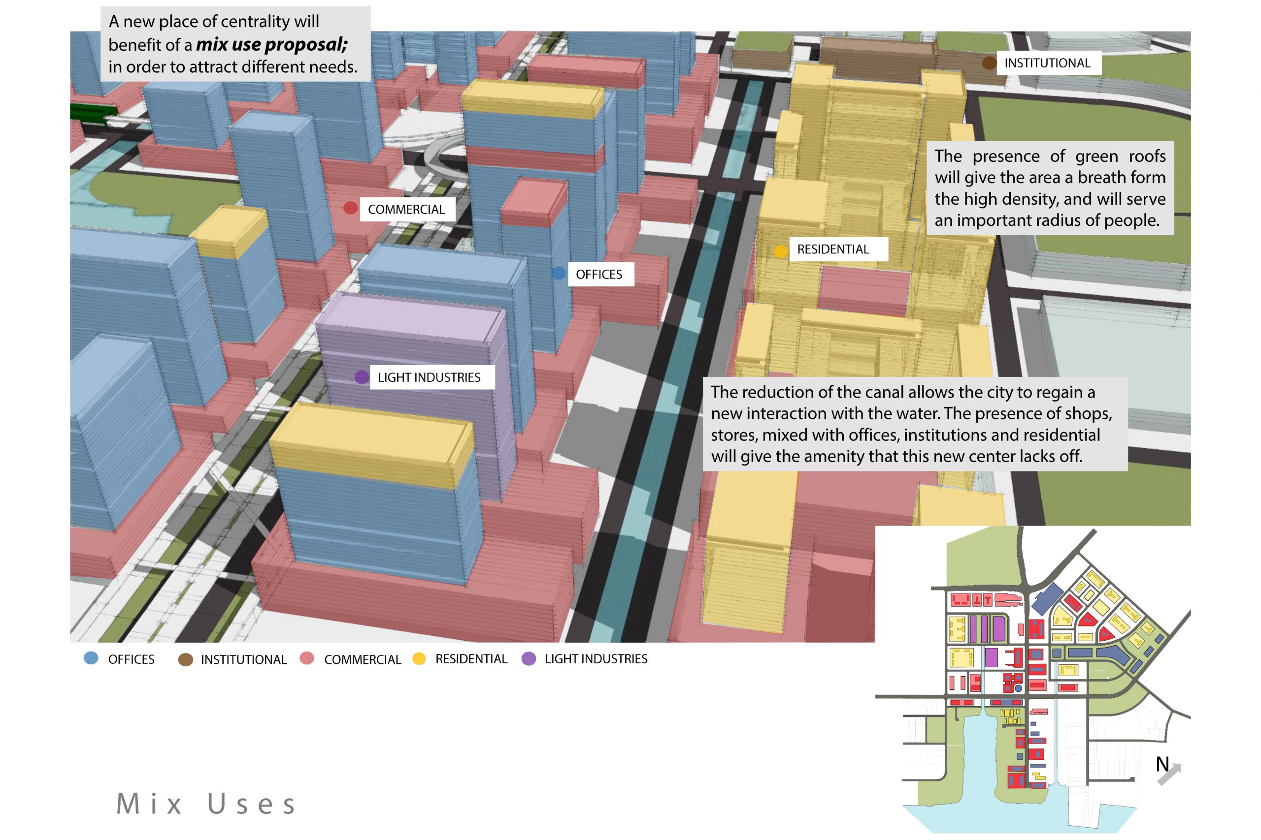
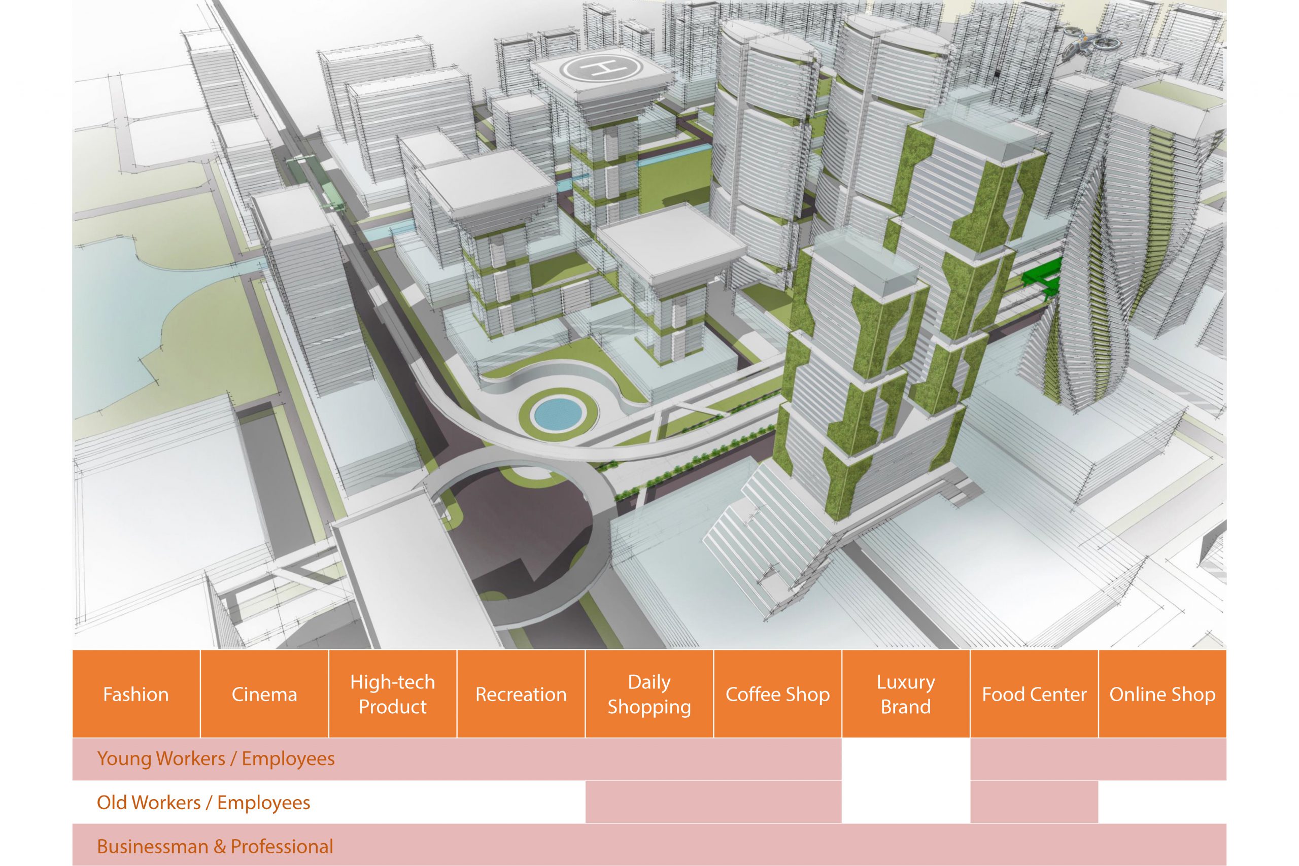
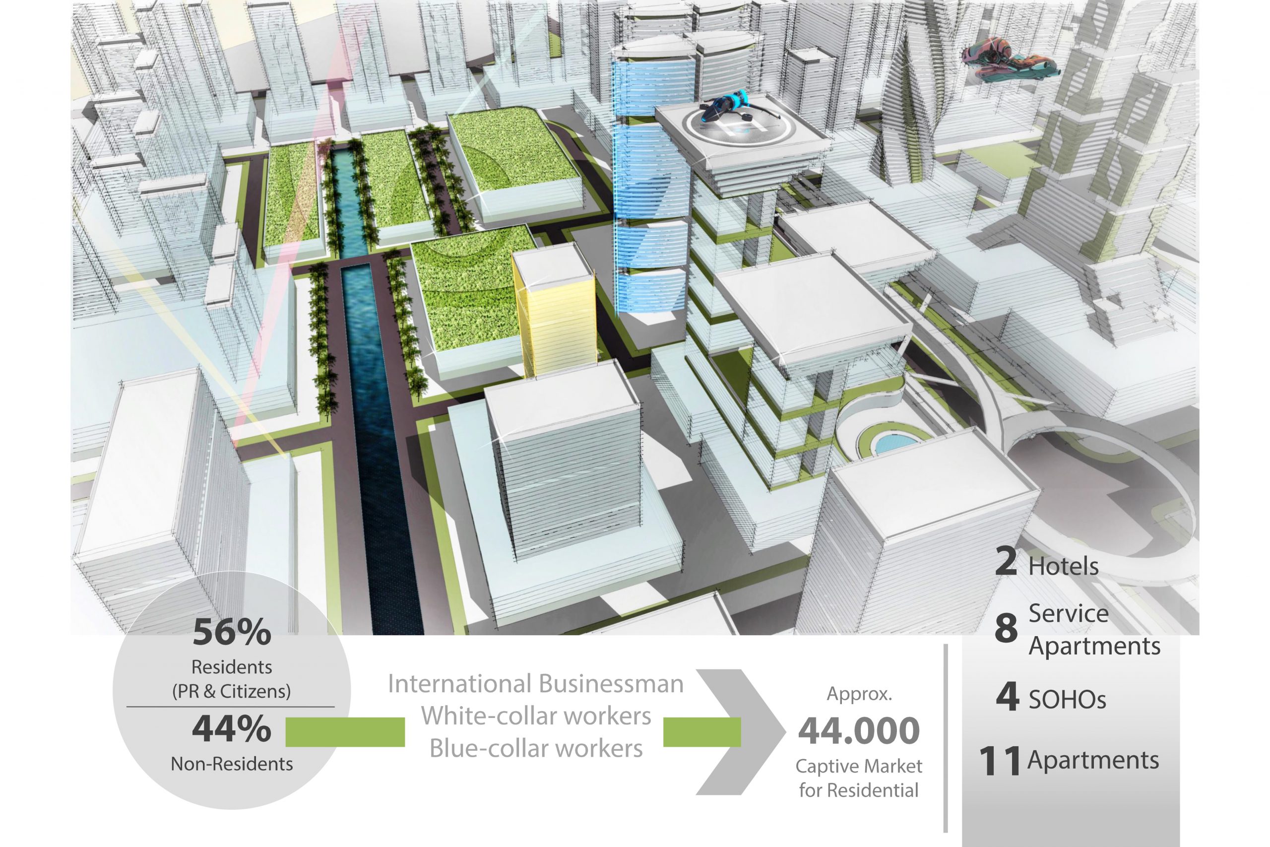
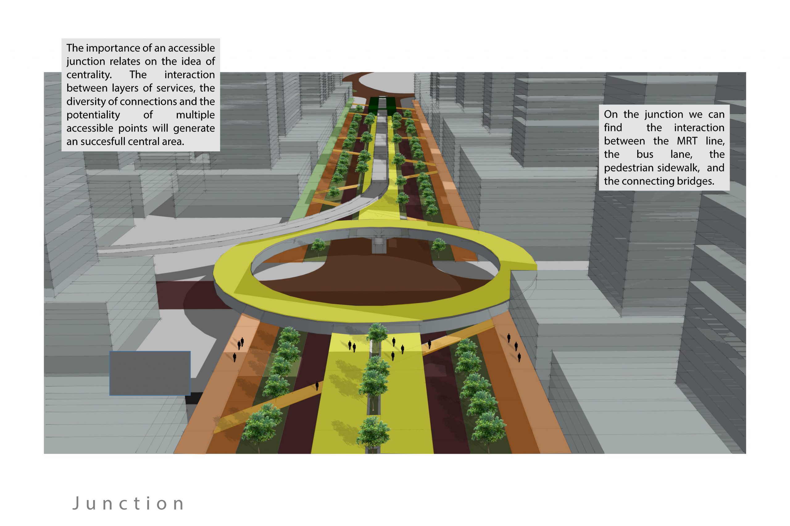
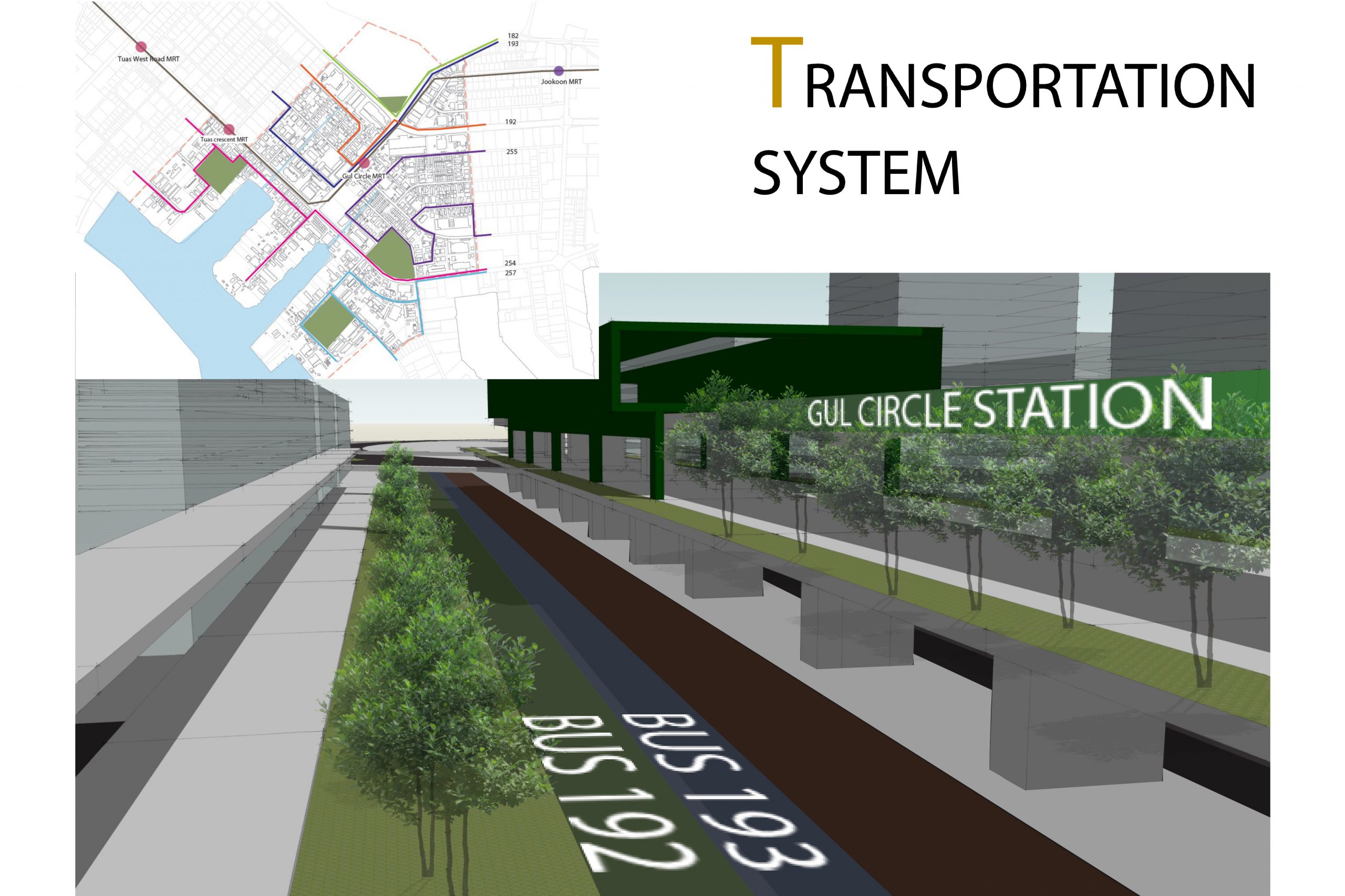
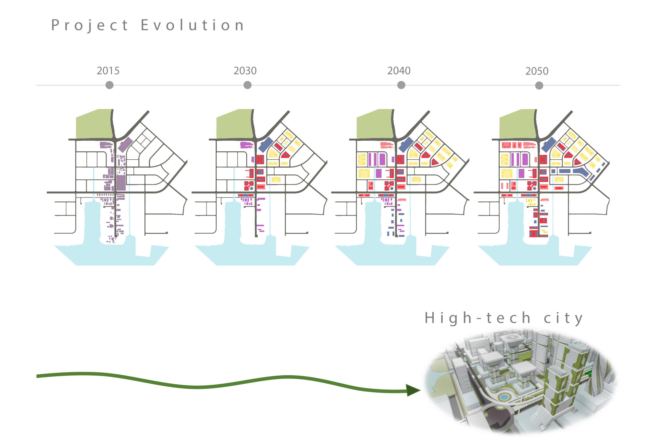
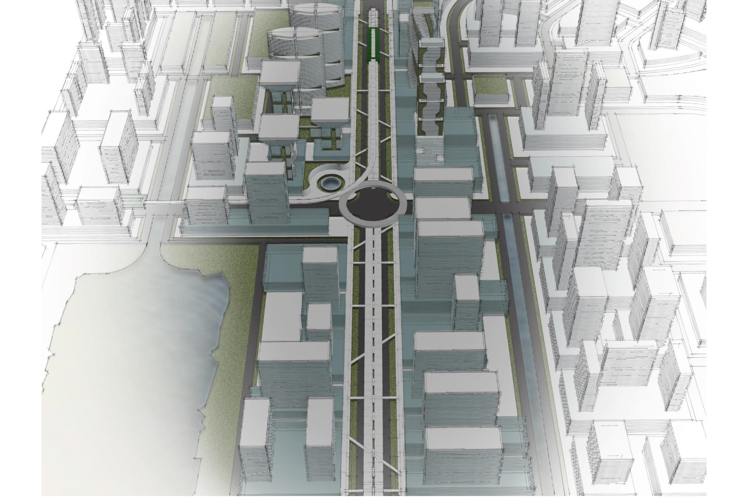
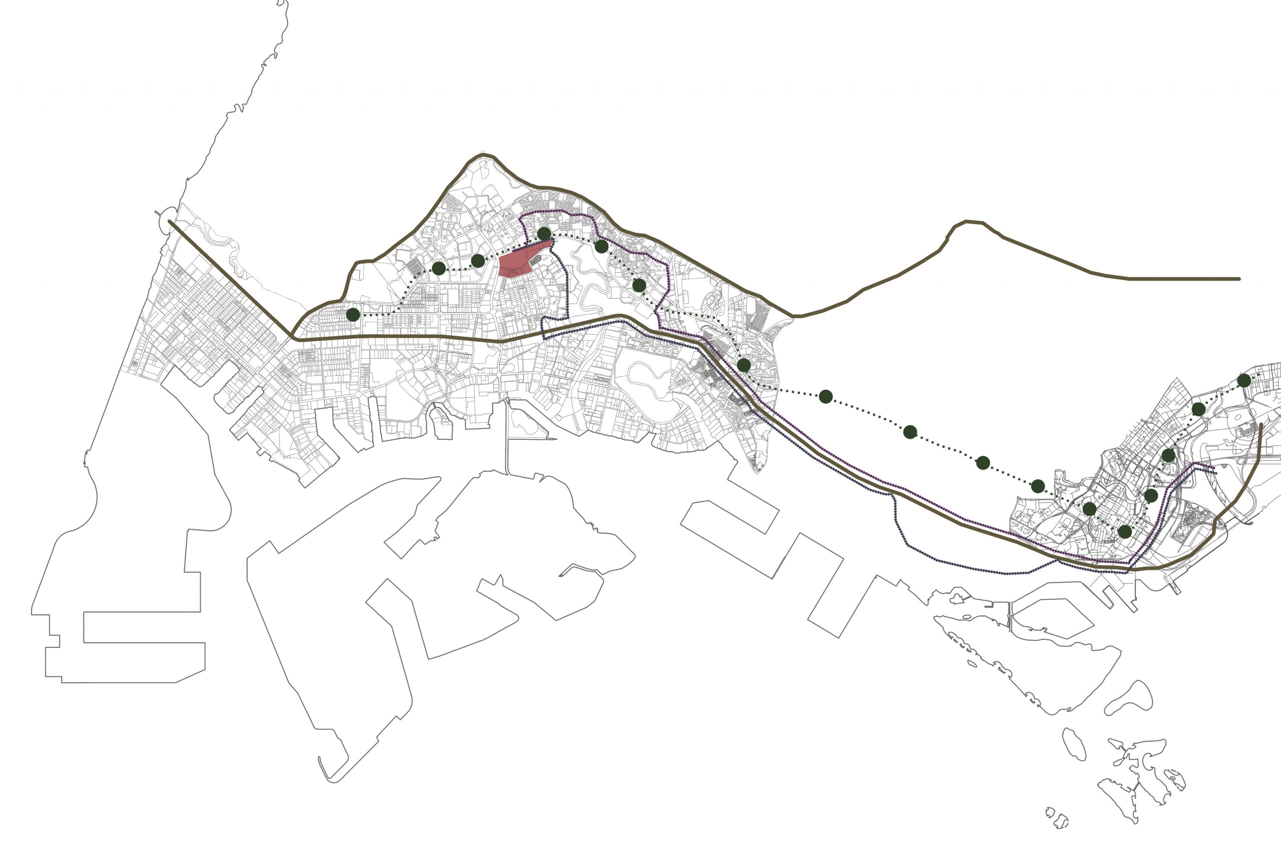
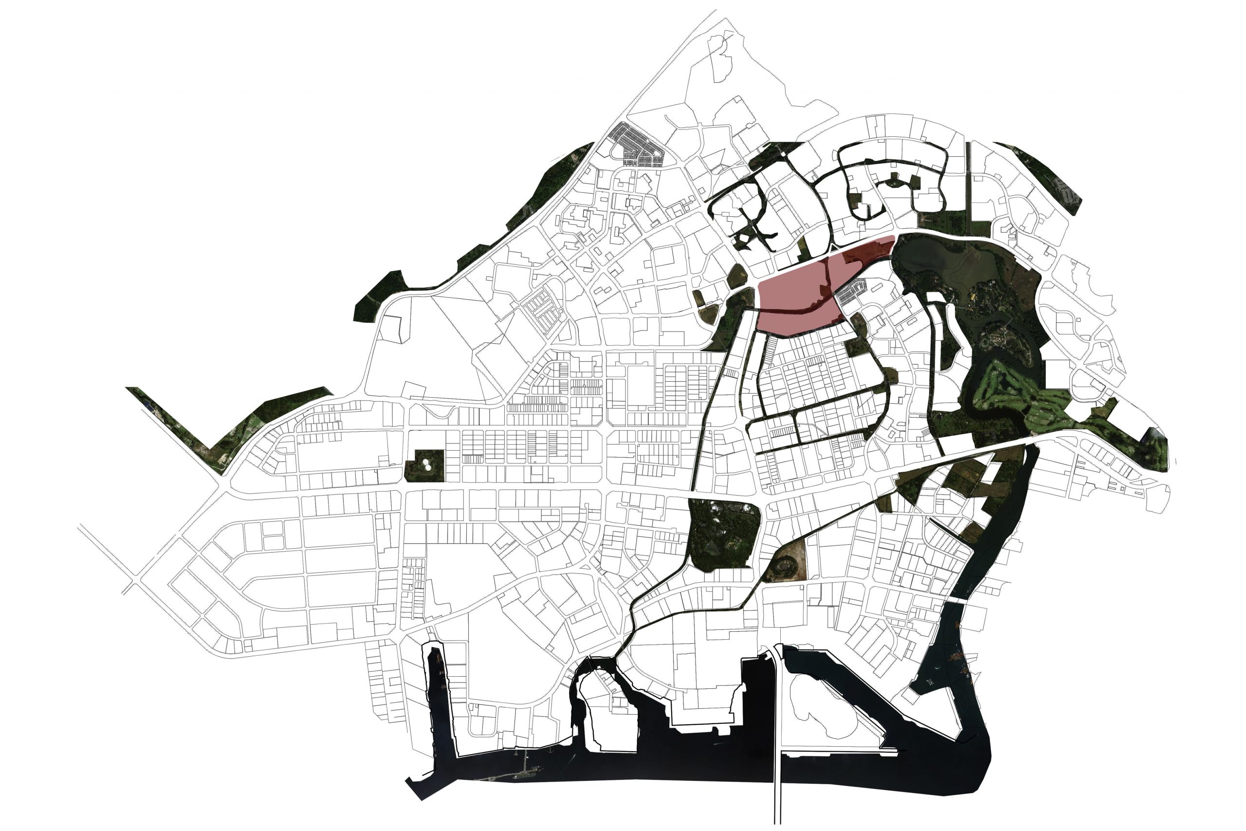
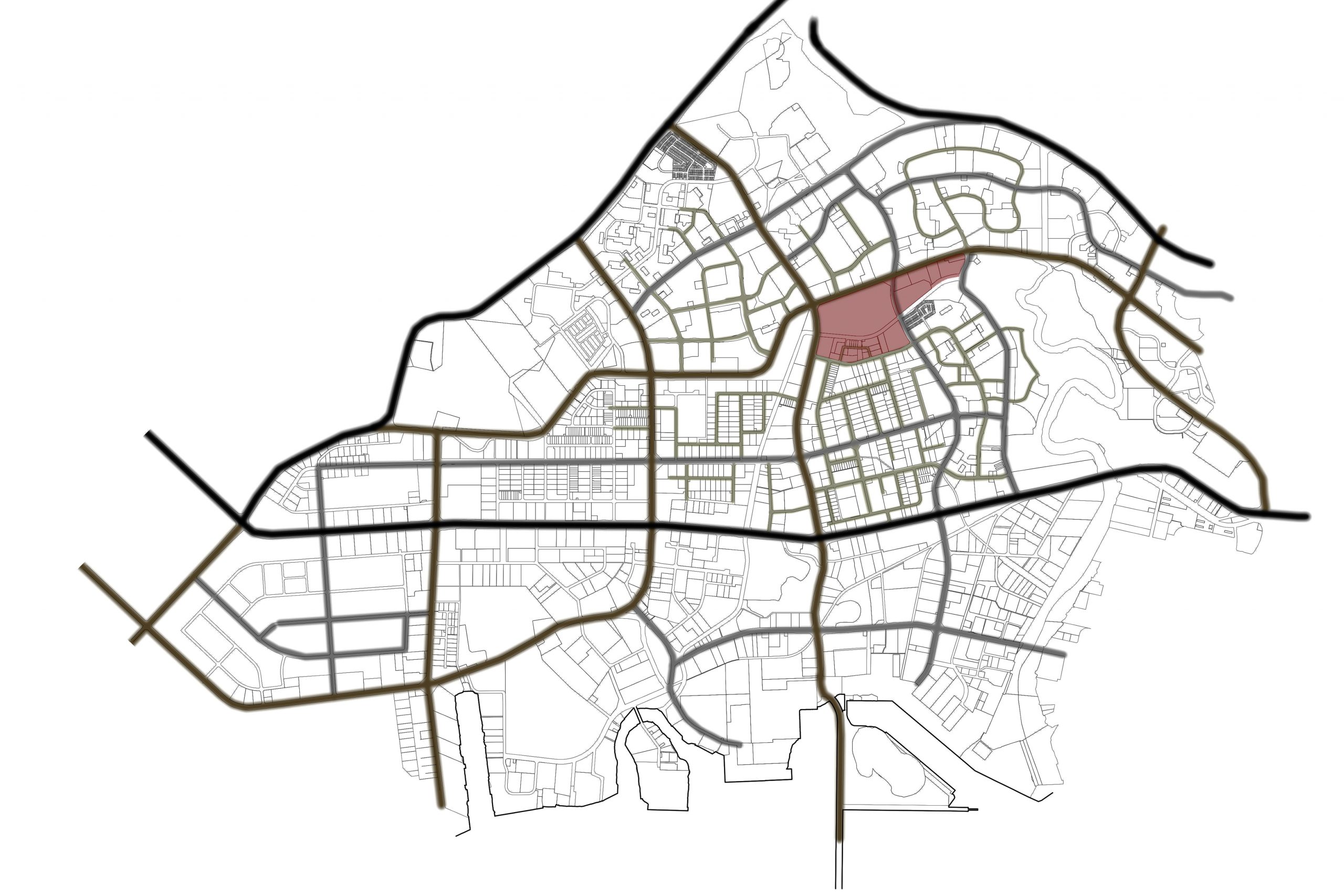
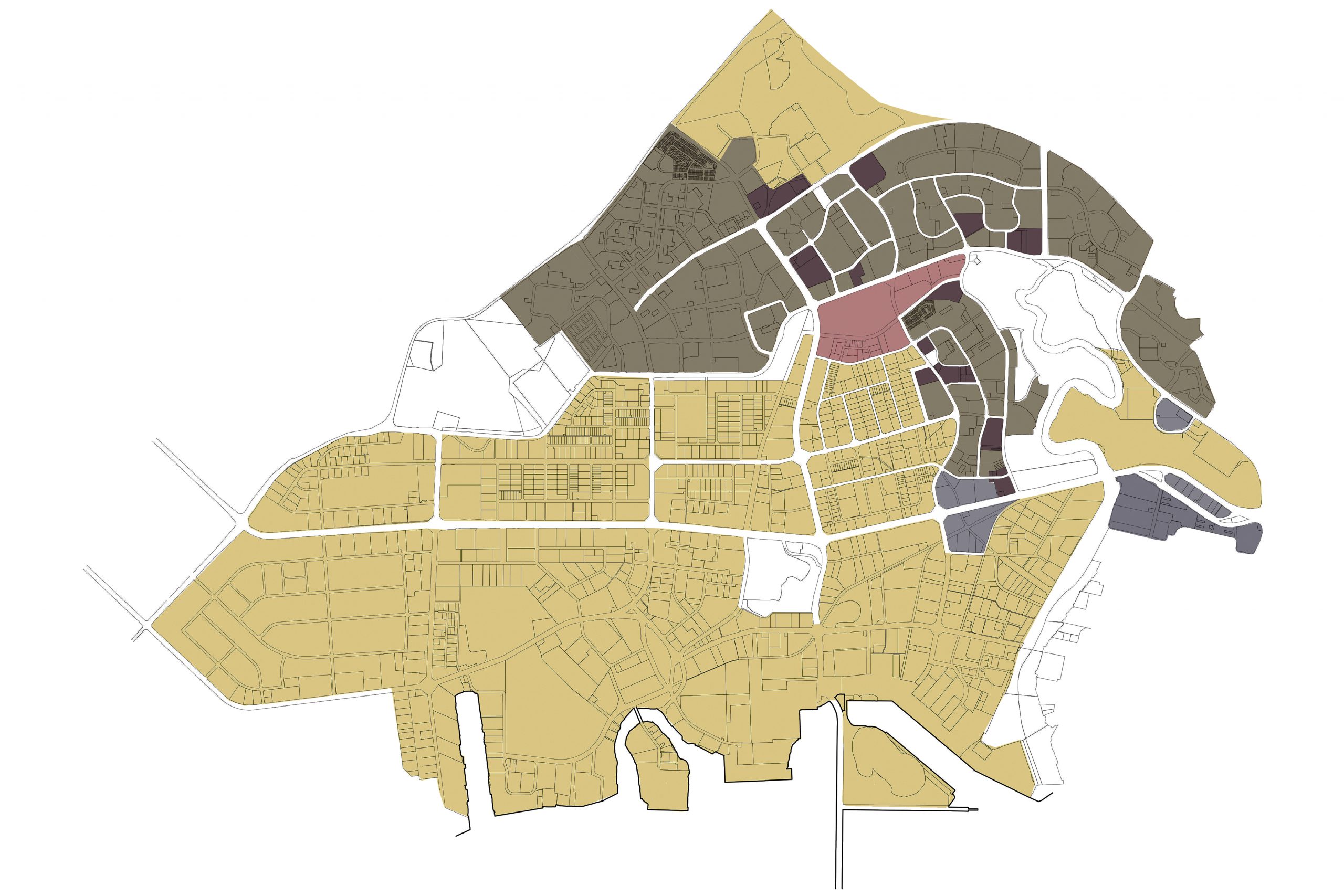
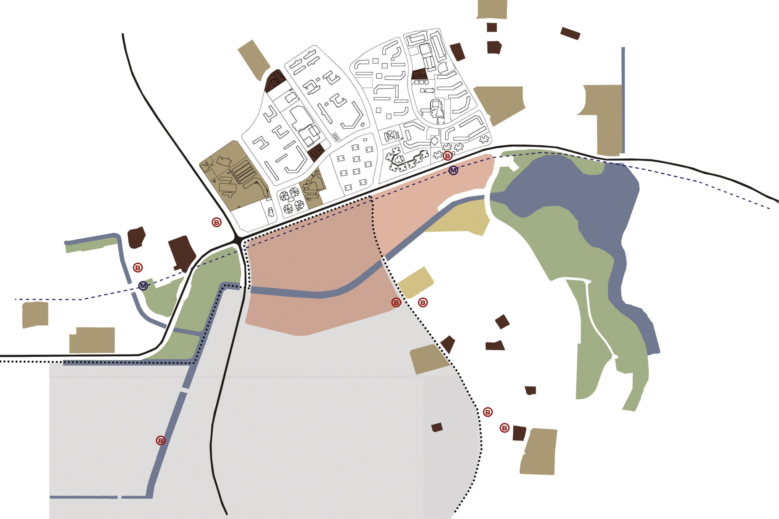
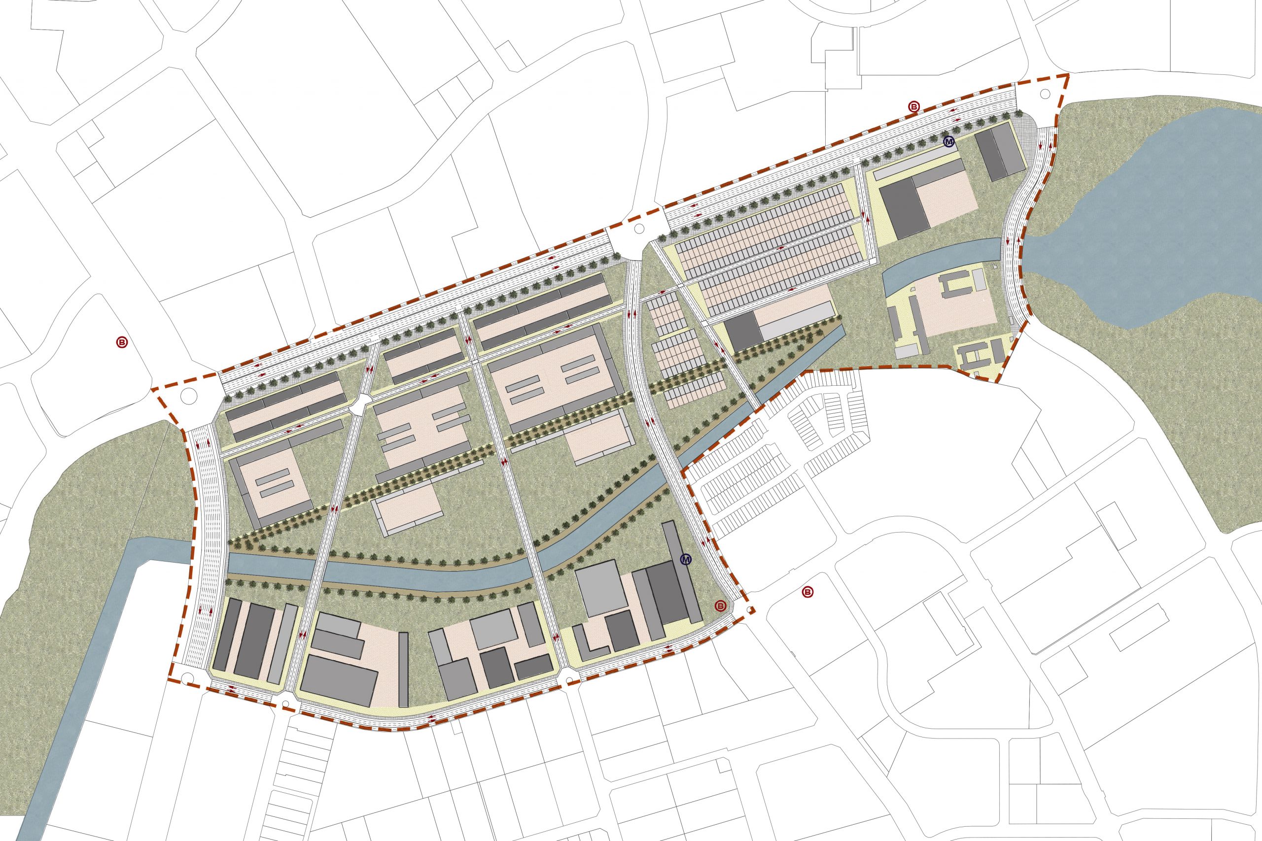
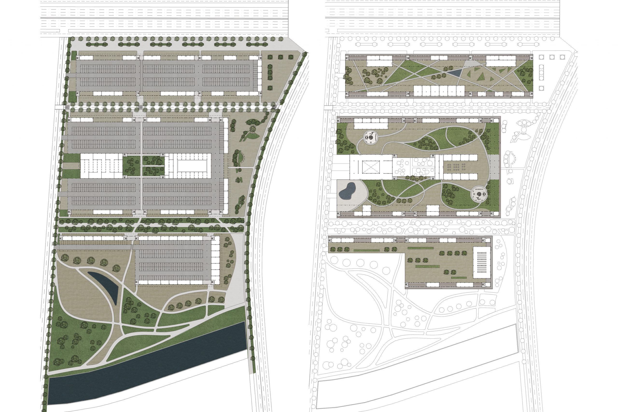
The main concept of this project is to know how to live in a new centrality in Jurong (Singapore). This is the industrial area which is located the main commercial port of the island. It’s about 150 Km2. This project was made in an internship organized by the JTC (Jurong Town Corporation) with several universities around the world (Jakarta, Beijing, Taiwan, Switzerland, Spain, Italy, Venezuela…). It was made in fifteen days at the National University of Singapore (NUS). They want to change this area in 50 years because they want to connect it with the rest of the city. We need to project a new centrality which works like a magnet where citizens will come to work and live there in a near future. We started studying the whole Jurong area (transportation, distribution centers, people profiles, commercial, residential, business, enterprises, industrial profiles). We concluded to make this centrality for a particular type of people. People which are developed in the field of high technology. This can be the “magnet” to attract people over the situation of the centrality. The main street is the high-tech road where the ground floors are the commercials and the high floors, the offices.
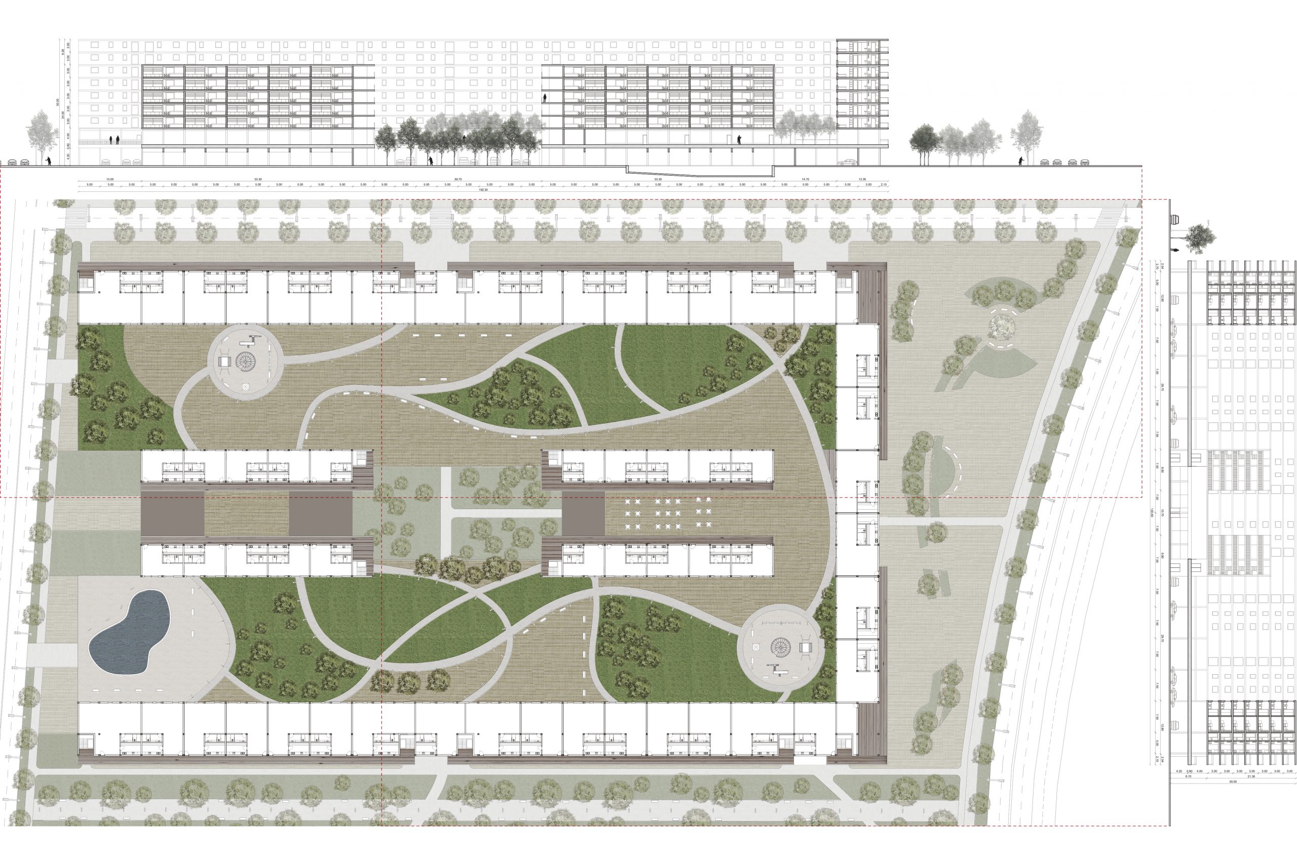
New residential housing sector
PROJECT INFORMATION
Location: Jurong, Singapore
Scale: 650000 m2
Software: AutoCAD, Photoshop, Illustrator
DESCRIPTION
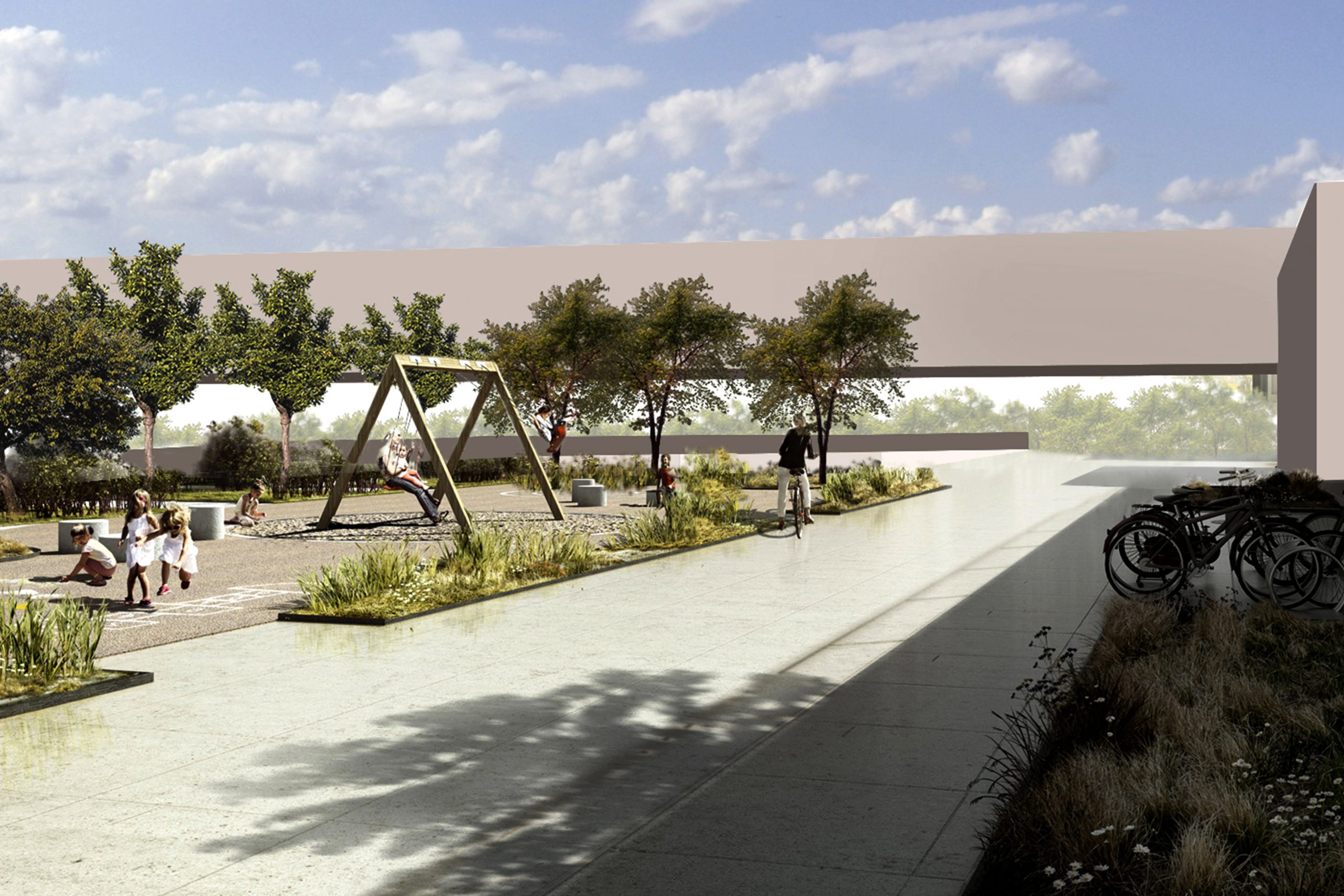
We start analyzing Singapore’s urban structure, specifically the western part of the city: Jurong. First of all, it is drawn on a territorial scale Jurong’s density (industry and port area), and it is compared to the island’s nerve and technological center (which is a touristic and working area). Secondly, it explains the connection between the center of the island and Jurong. It consists of two main transportation roads, which work as transportation arteries (one that connects the island with Malaysia and the other connects the center with Jurong). The urban planning proposed project is on a 1:5000 scale. The streets are detailed and we look for a constructing typology (using as a starting point the surrounding existing buildings). Basically, we propose two types of buildings, blocks of single-family and multi-family houses. Green spaces are also detailed, from a lineal axis which is parallel to the blue axis, and which changes shape according to its surrounding necessities. It works like an “acoustic cushion” when it comes to insulate the streets against the environmental sounds of the closest blocks. The facilities are placed strategically in order to give new facilities to the area in question; facilities which do not exist around the close environments.
PRESENTATION
Boards
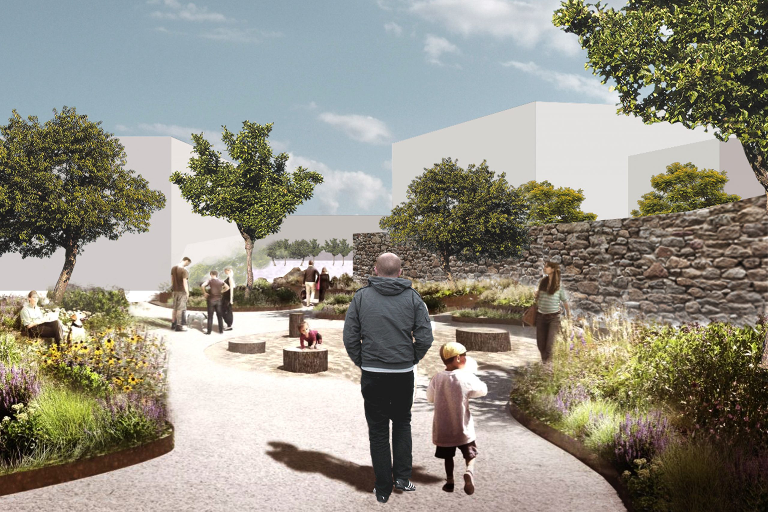
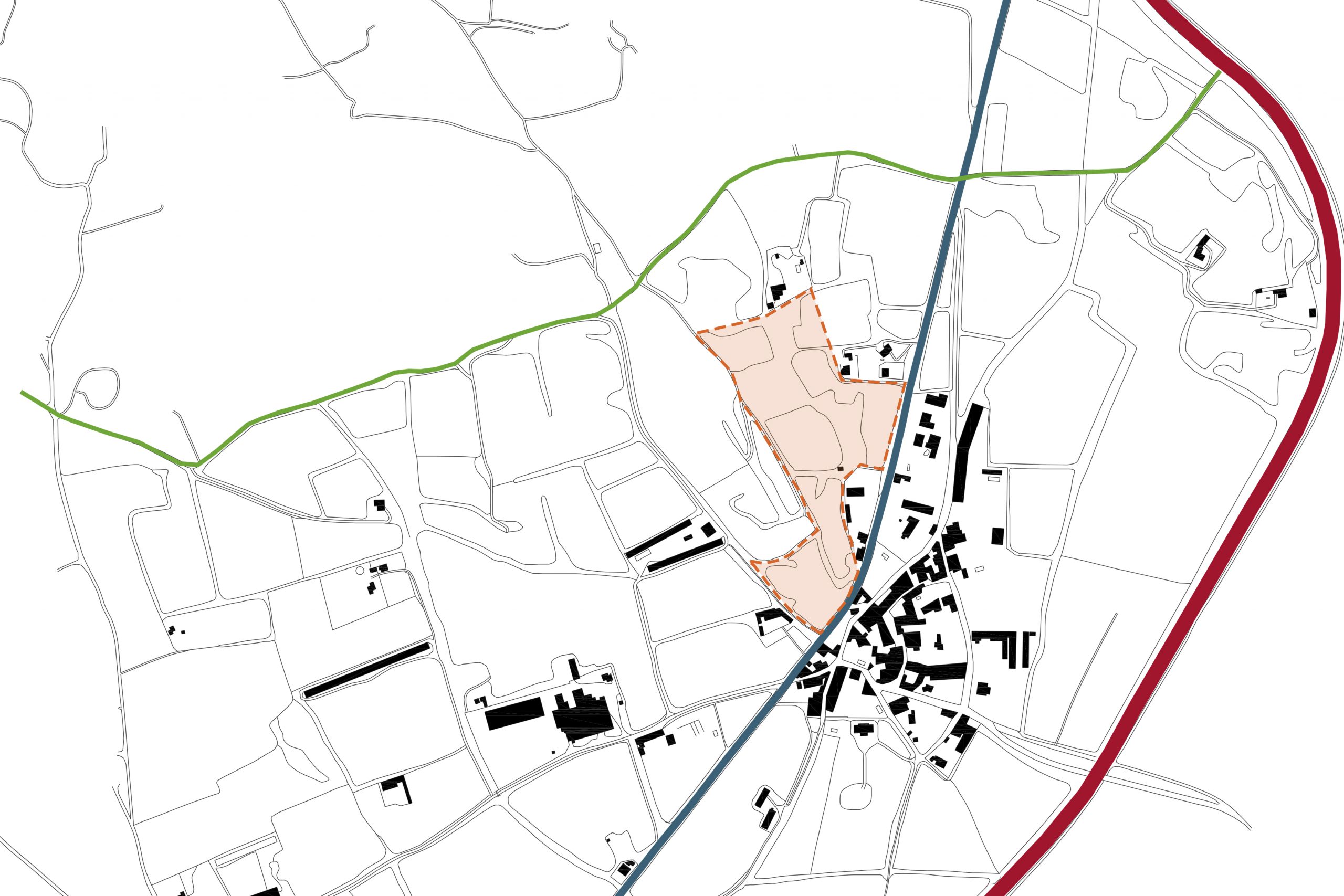
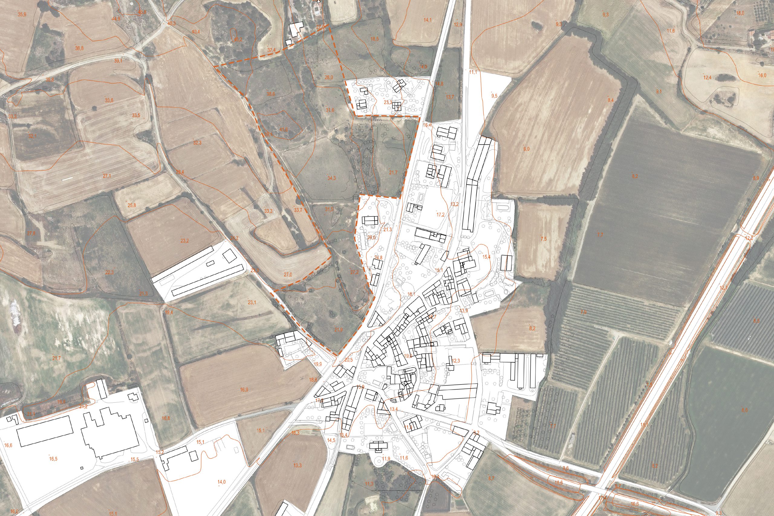
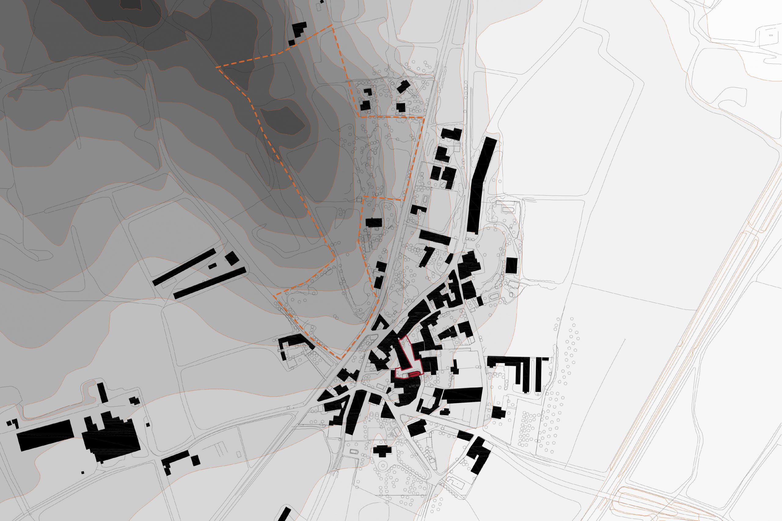
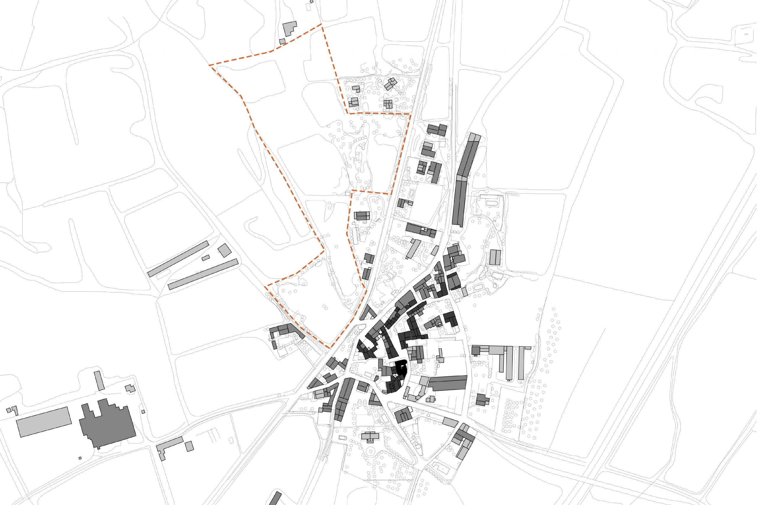
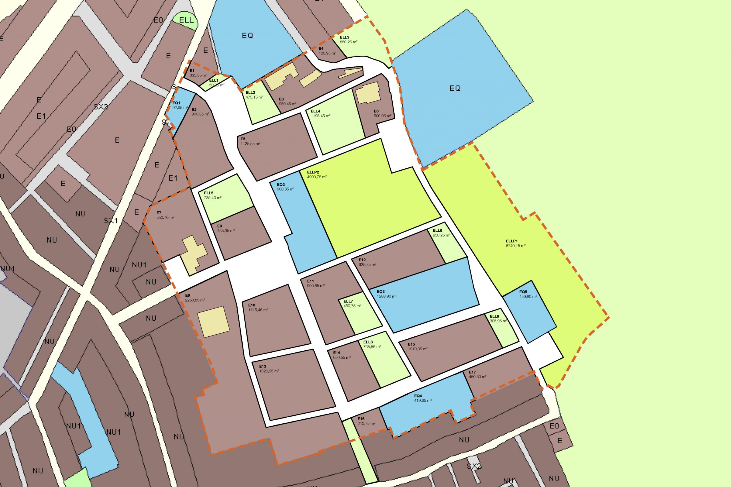
Partial urban plan for Tor
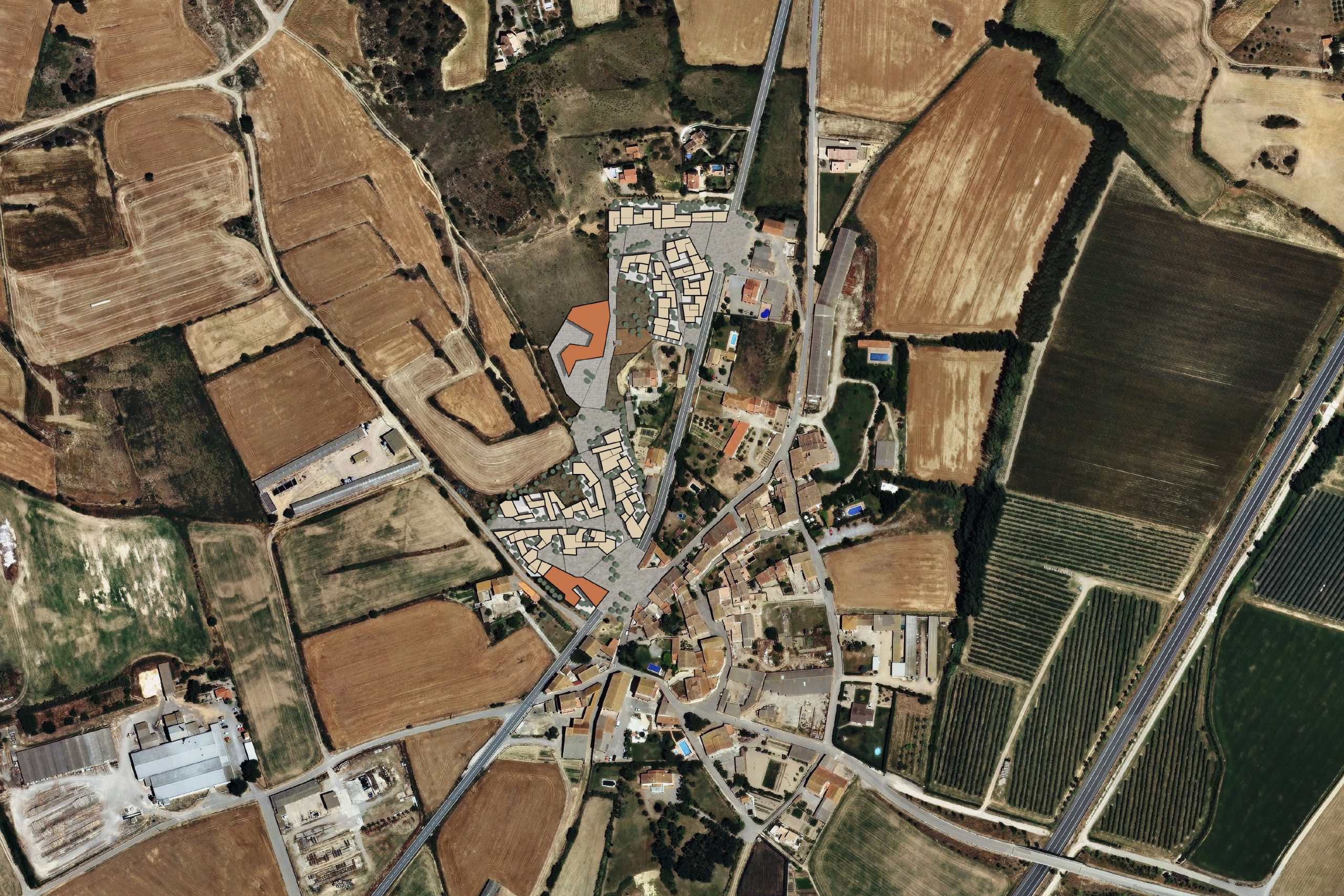
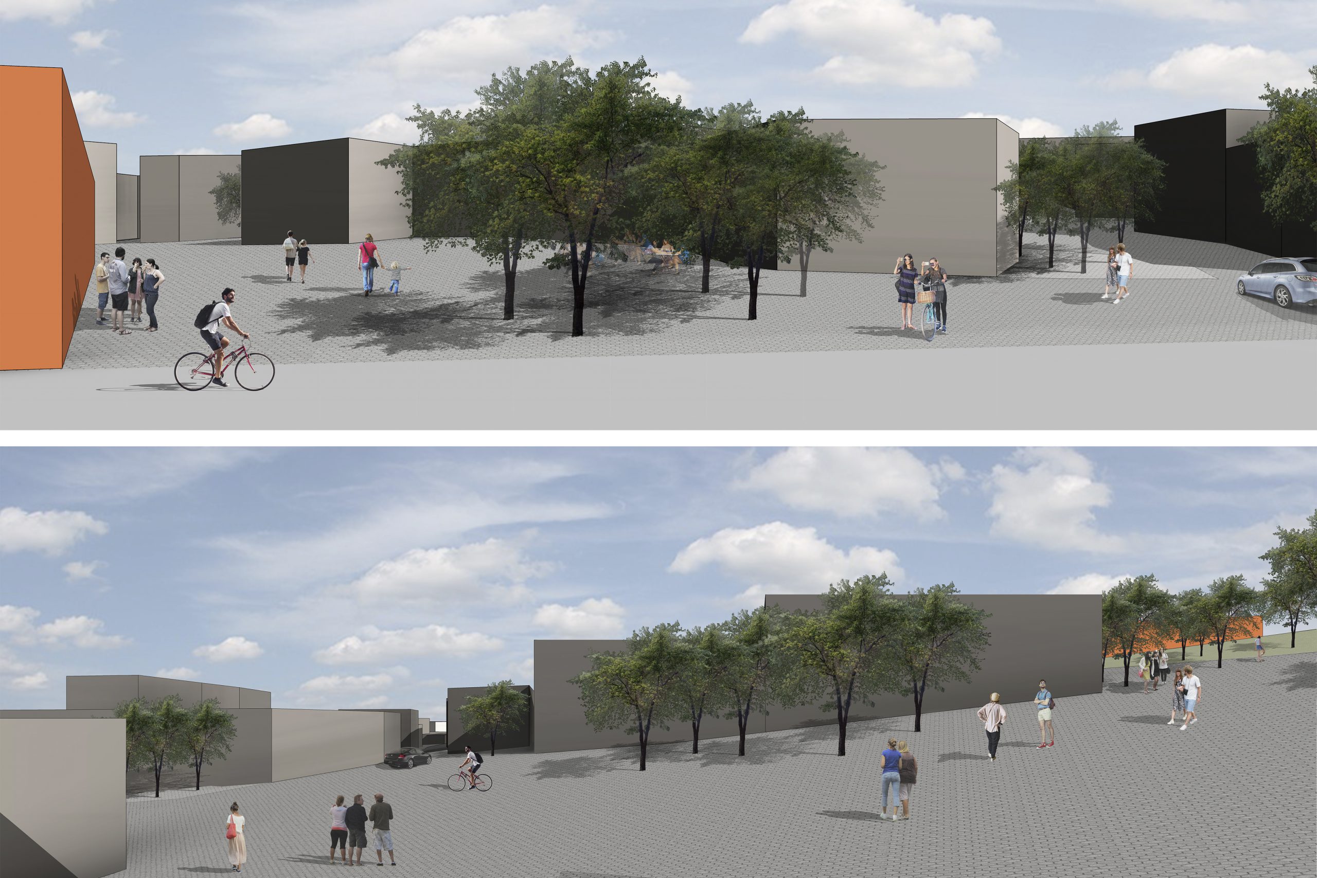
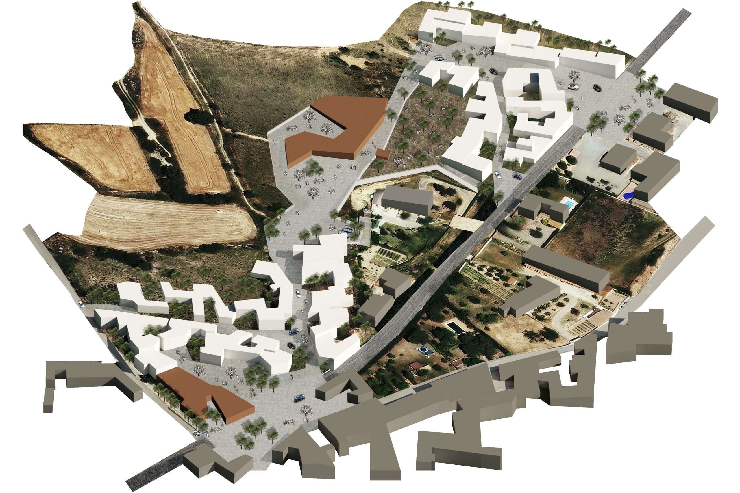
PROJECT INFORMATION
Location: Tor (Girona), Spain
Scale: 48000 m2
Software: AutoCAD, Photoshop, Illustrator, Revit
DESCRIPTION
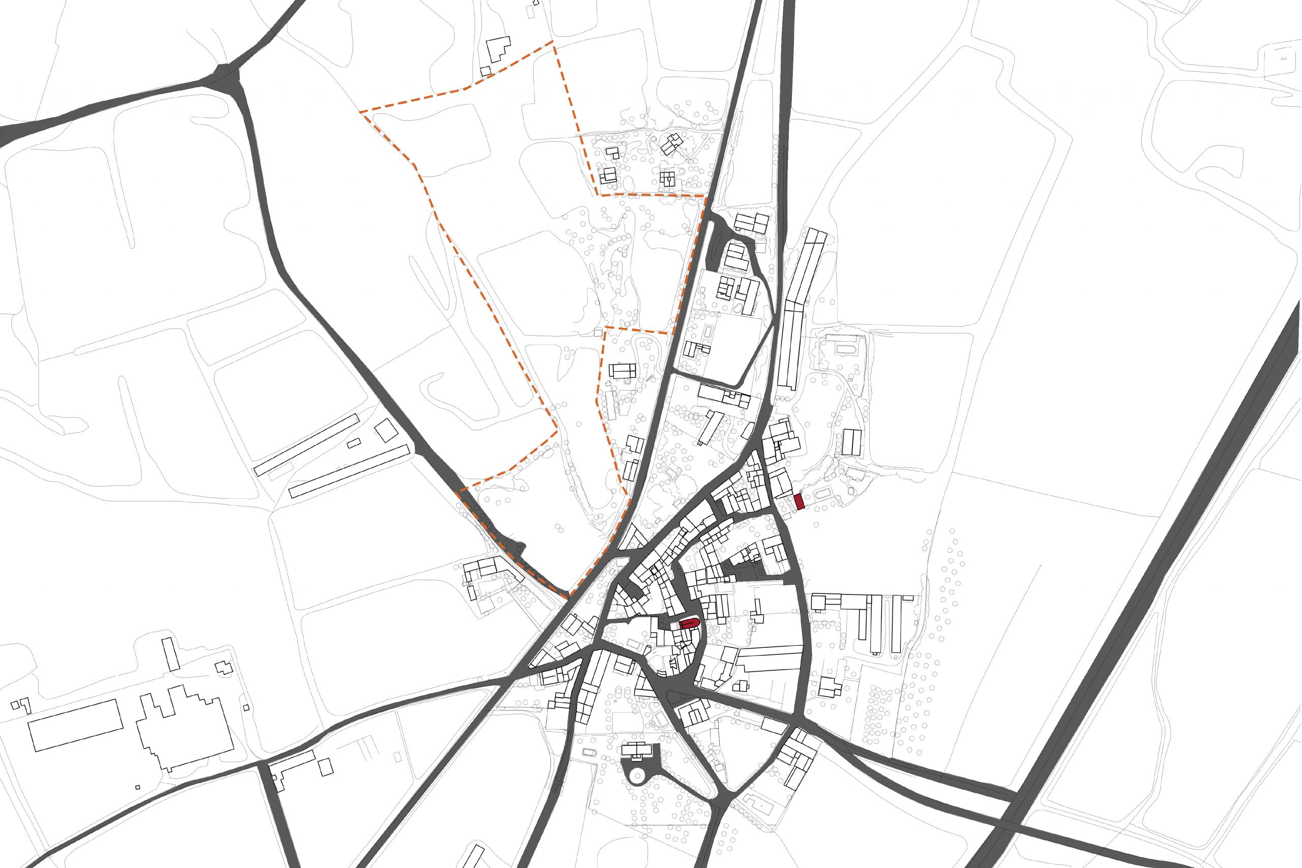
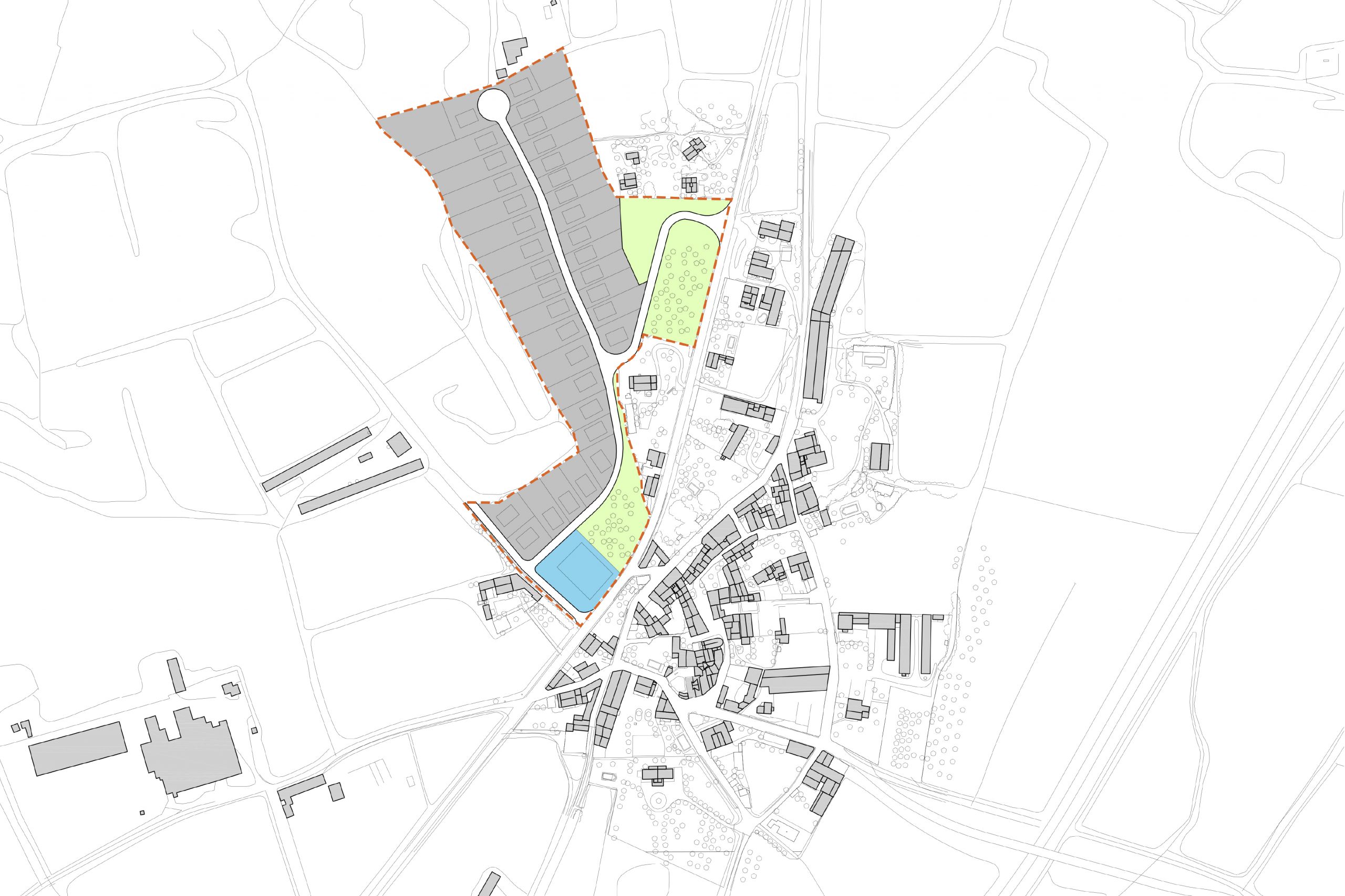
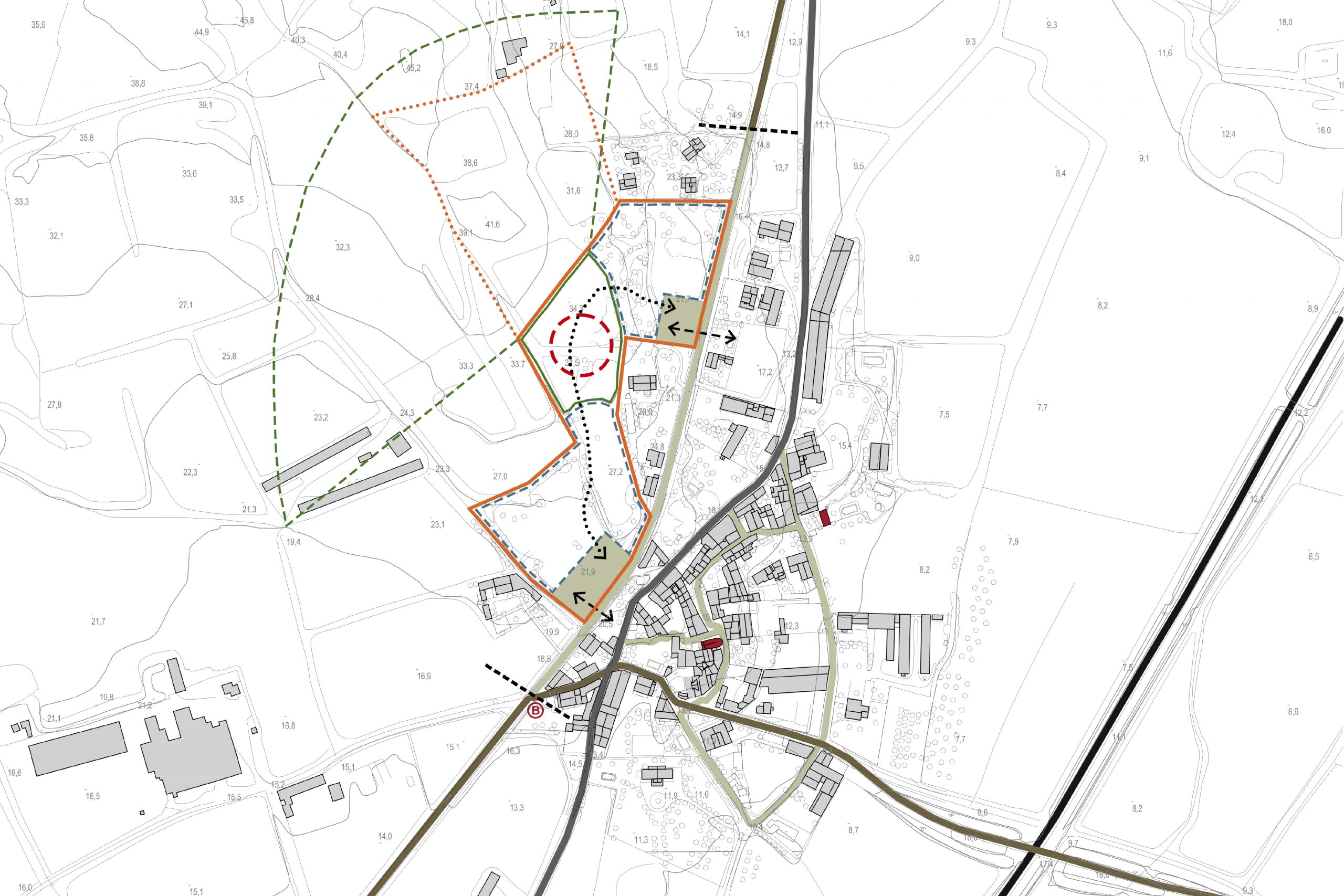
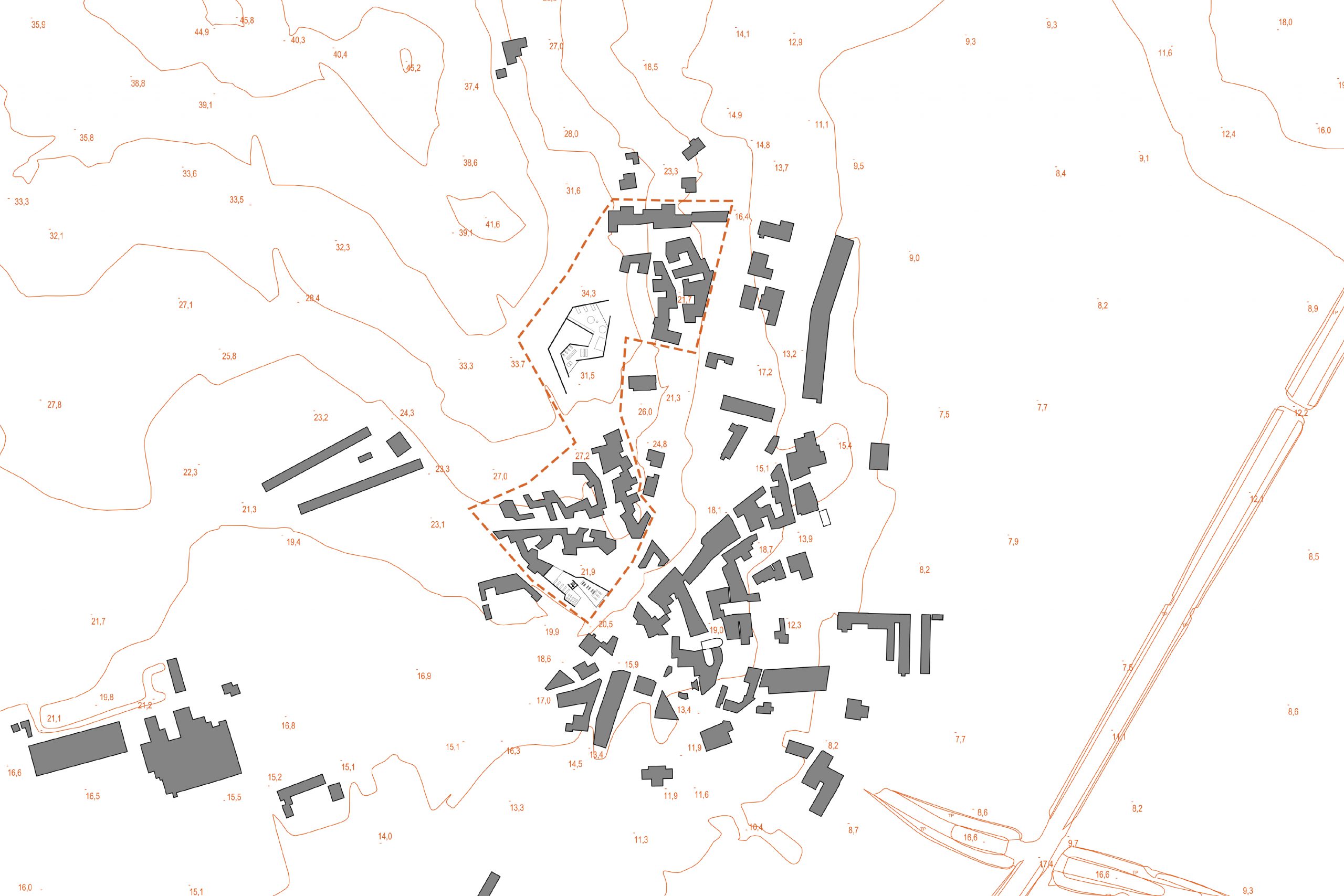
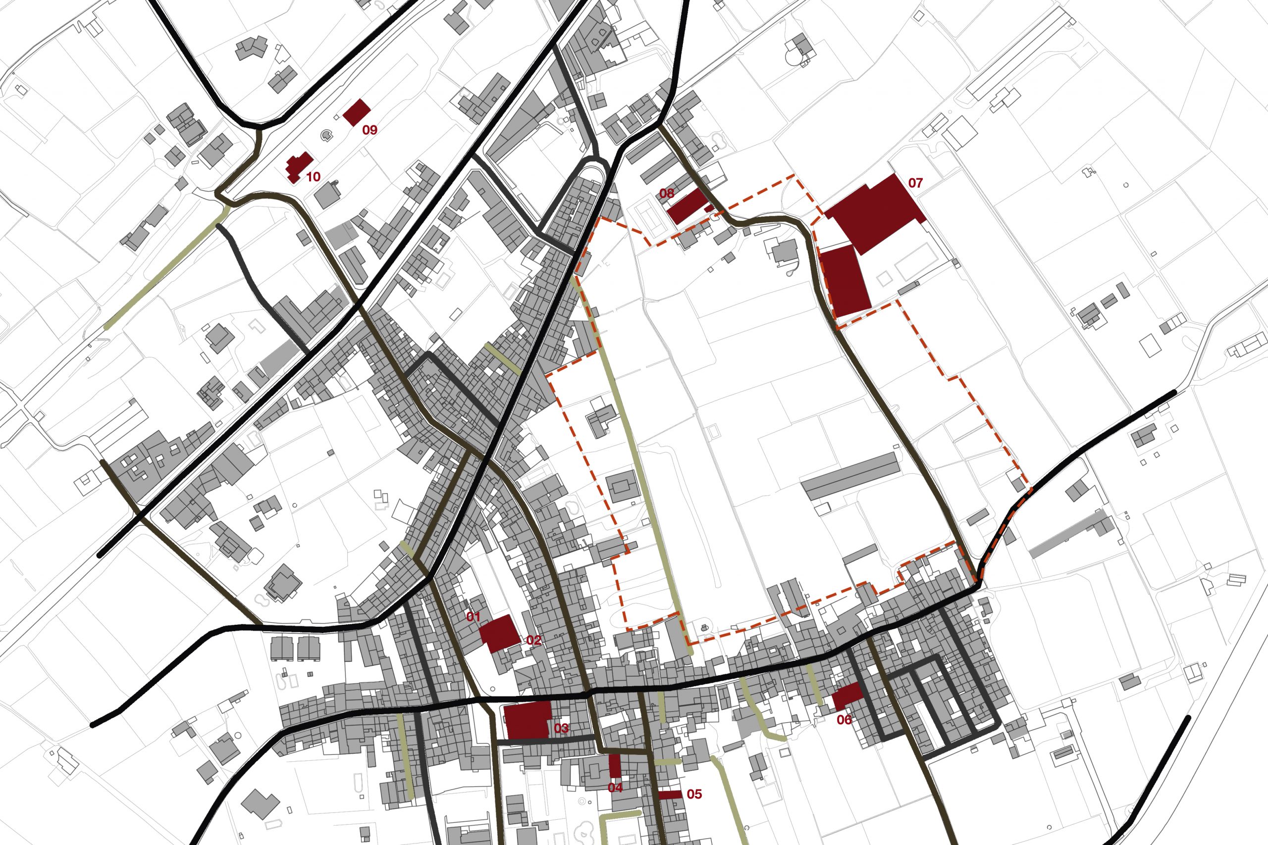
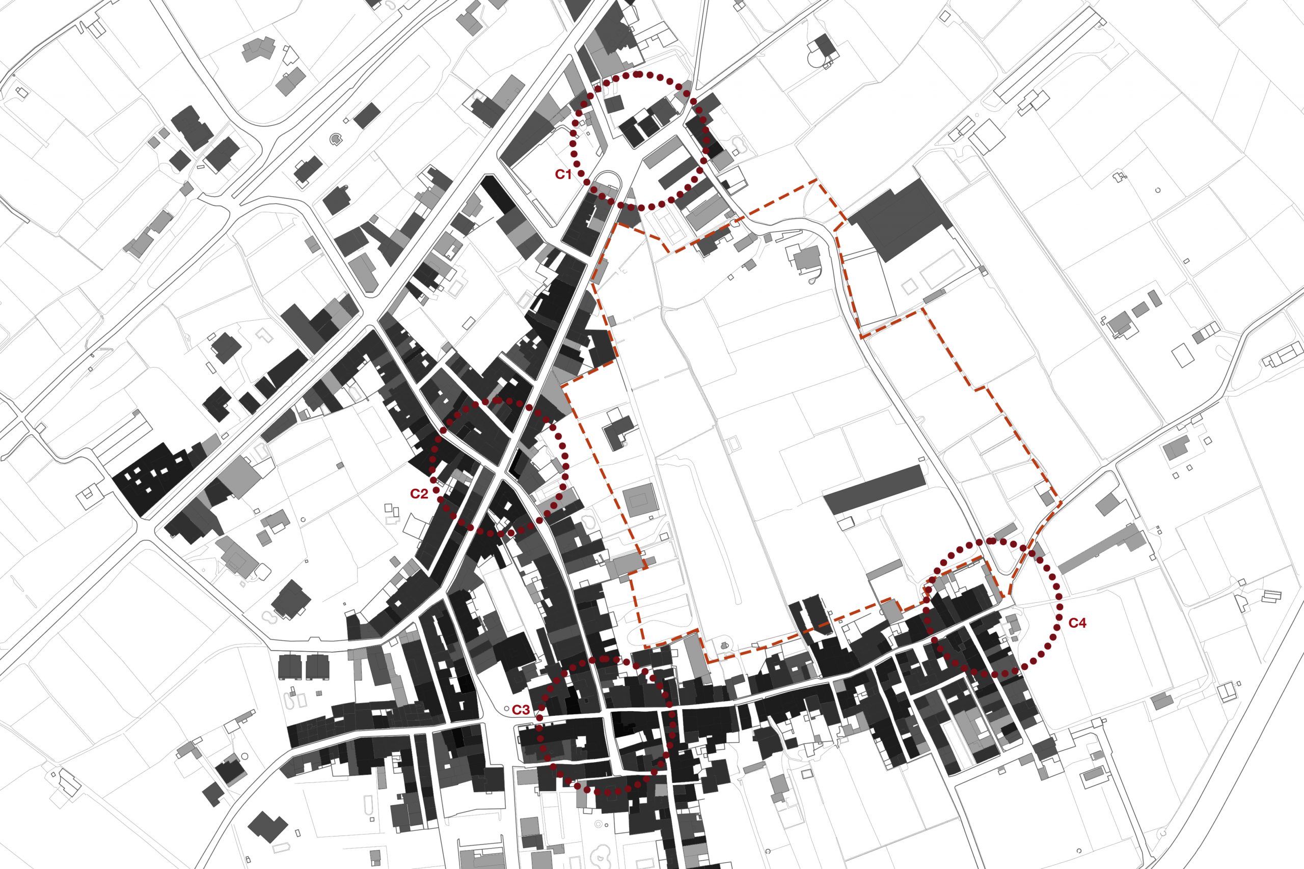
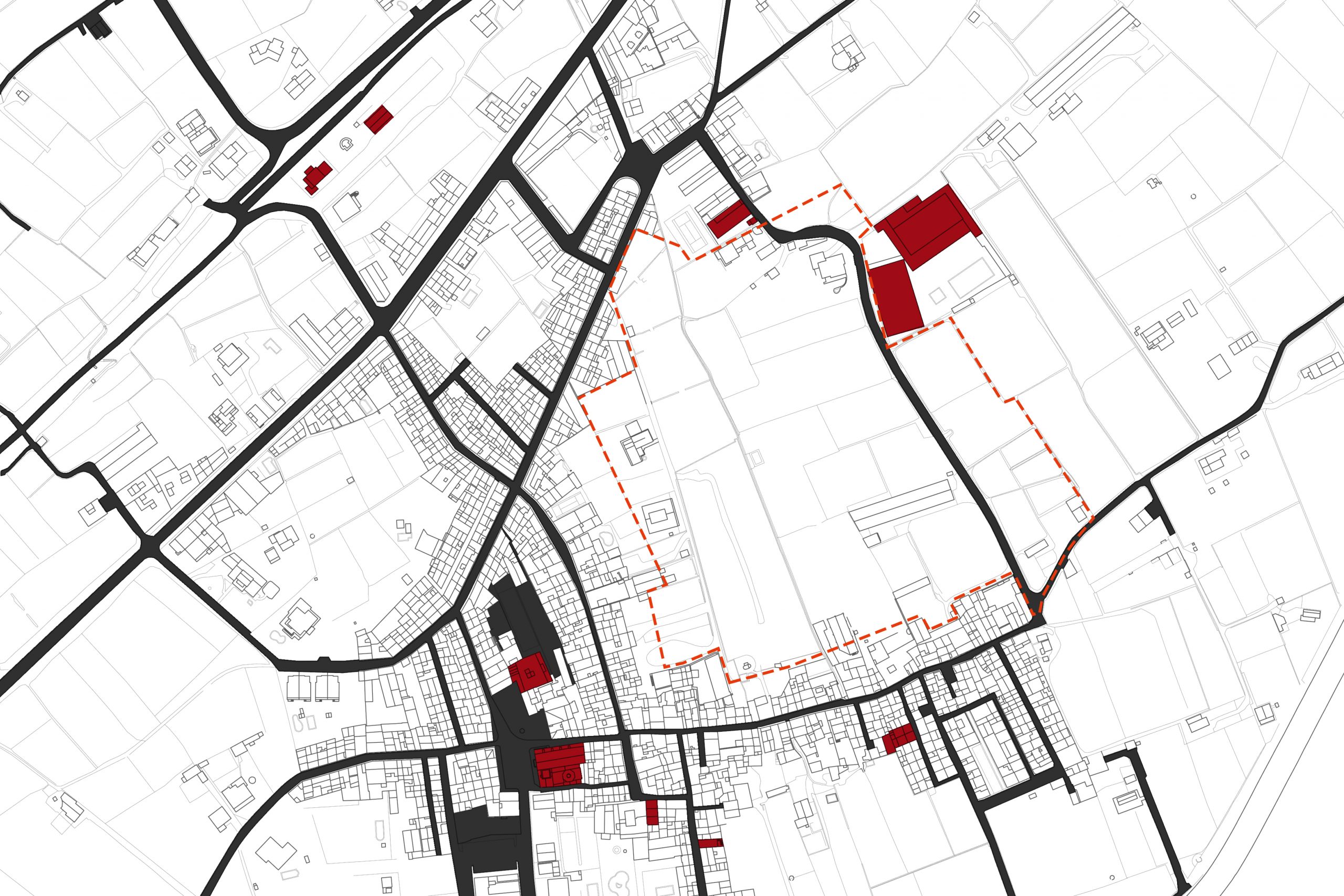
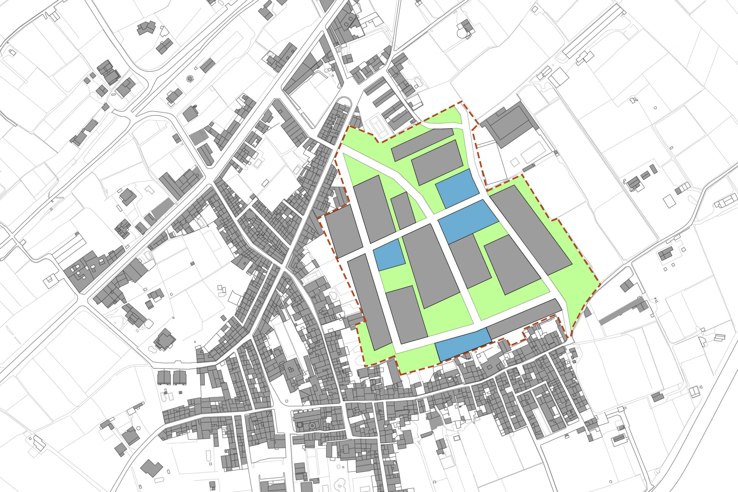
The municipality of Tor wants to make a partial plan for the expansion of the village. There are some decisions taken before starting the proposal. The first one consists in to limit the actuation area to the level 30 m height because the topography is too high to have a relation with the town. Secondly, it’s necessary to do something to the old main road of the village because this new part shouldn’t be detached from the rest. Moreover, the residential area is separated in two parts and the main facility is located into the highest point. This allow people to have good visuals of the environment and to be surrounded by green areas. After these decisions, I started with the proposal following some guidelines. Firstly, there are placed the two facilities that I considered appropriate for Tor. One is the “Old house of Tor” (located at the first access with a square and in relation with the town) and the other is the “Interpretation Center of La Tallada” (located at the highest point). Secondly, the streets. It is tried to follow the topography lines. Finally, having a look at the existing residential area, it is tried to do a similar housing, following the same size and density.

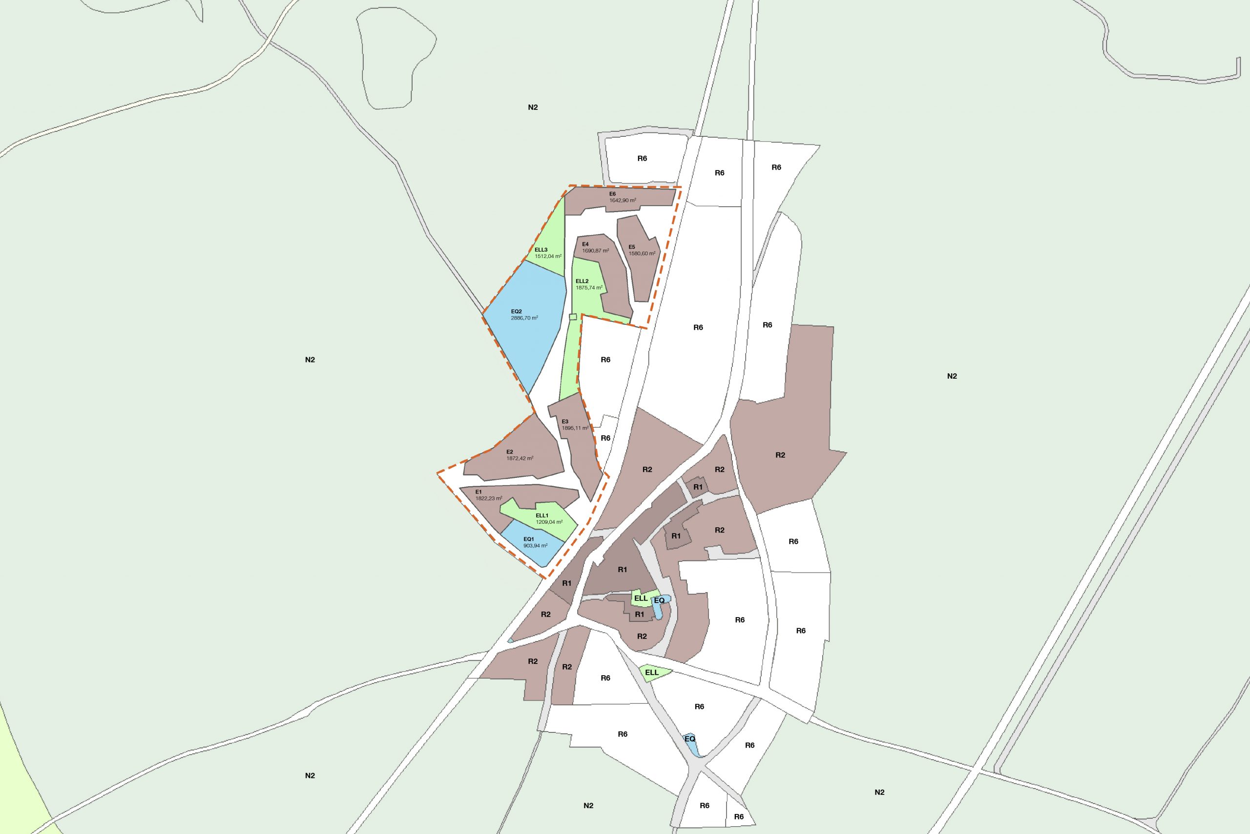
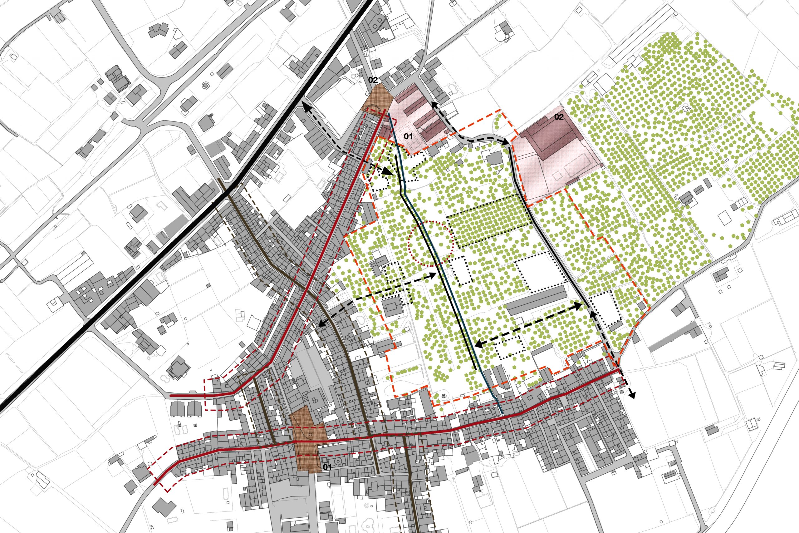
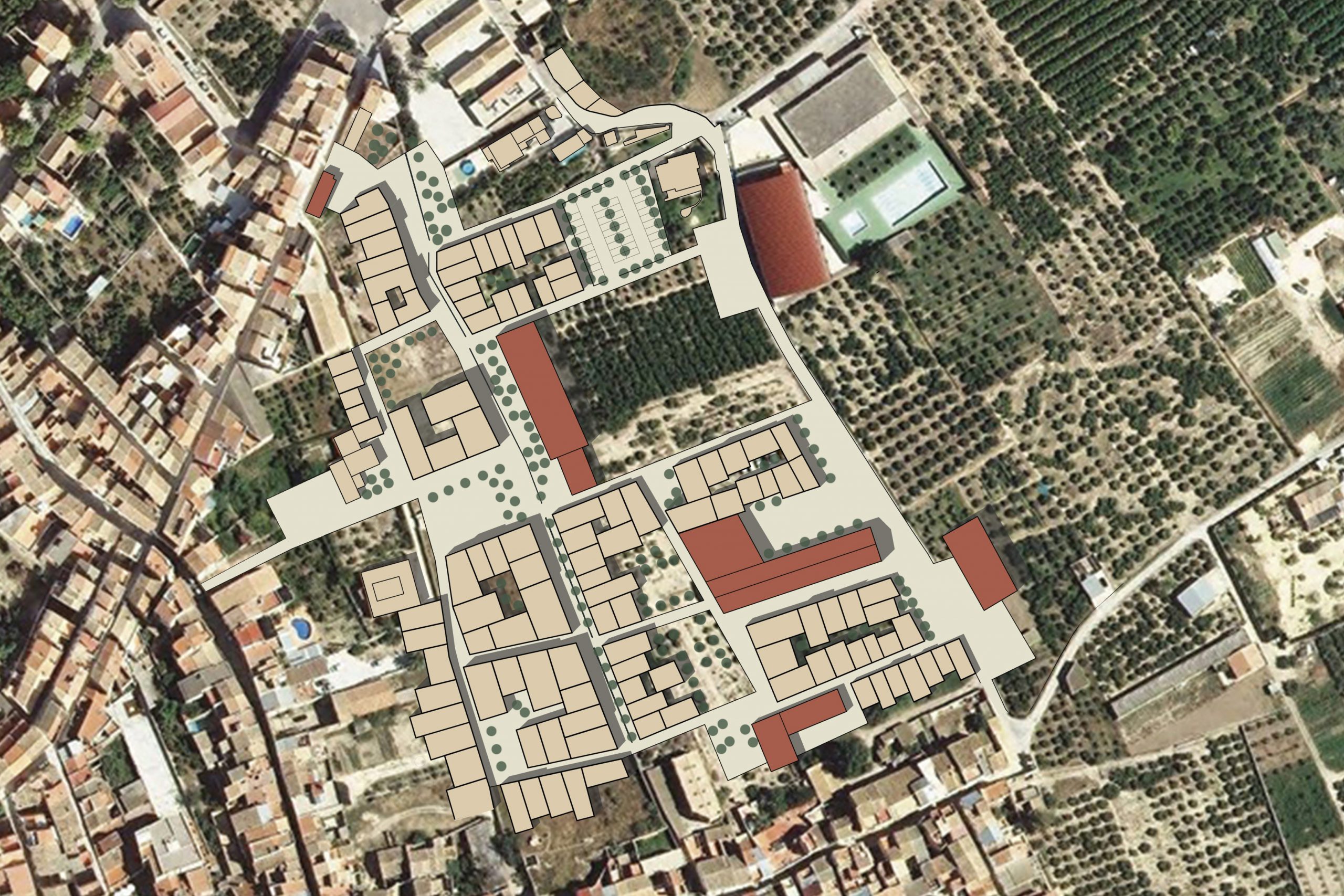
Partial urban plan for Xerta
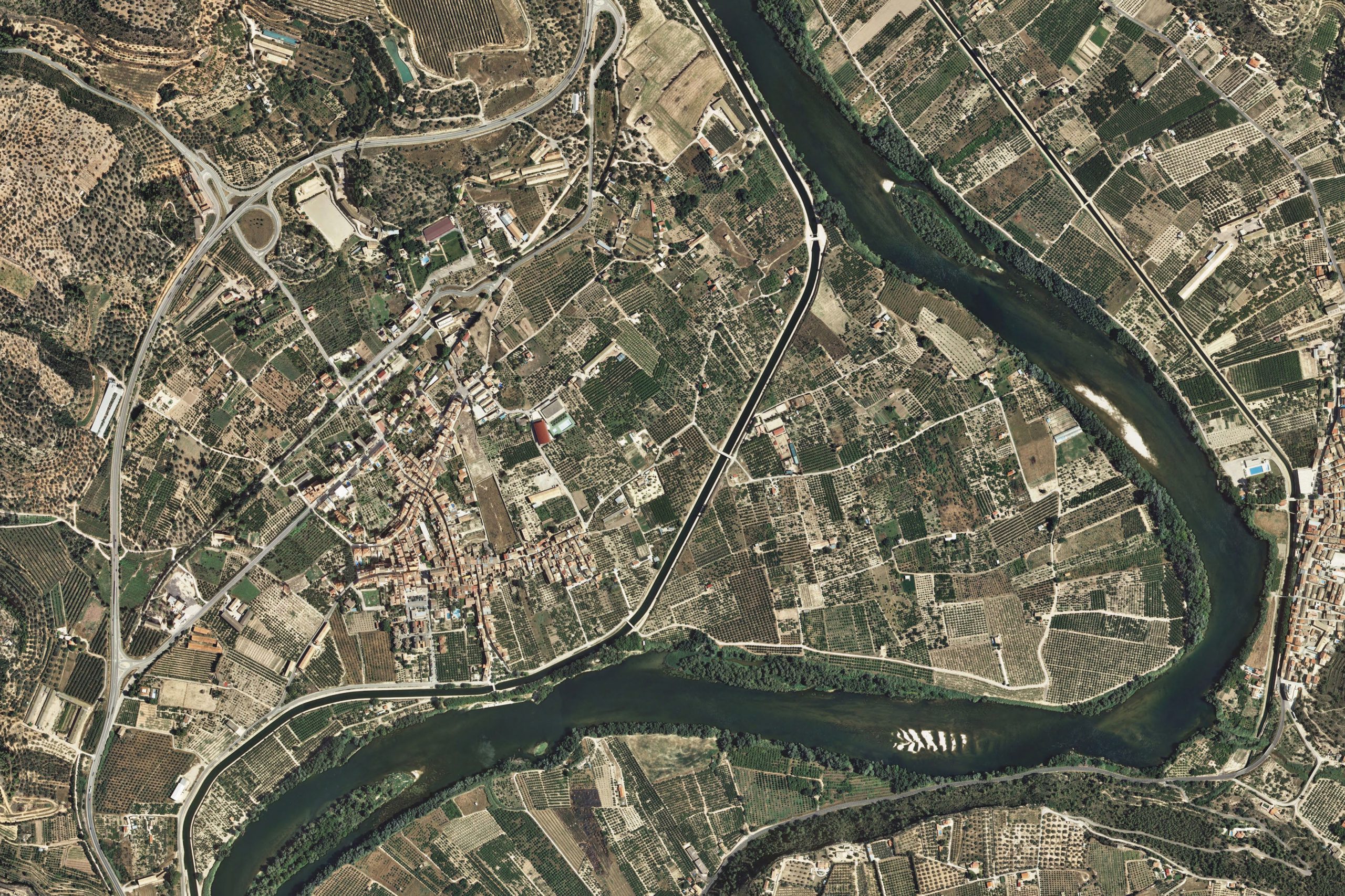
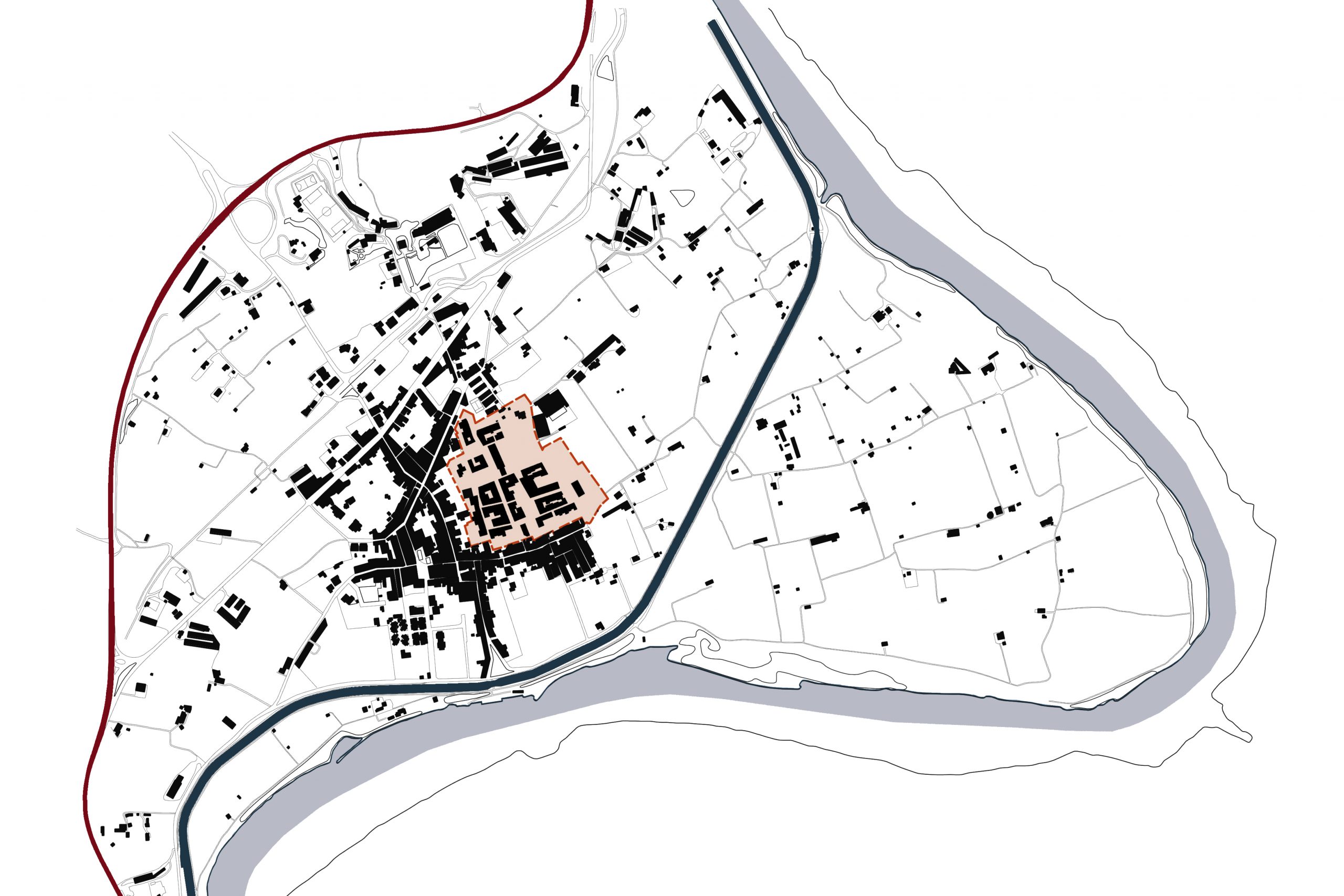
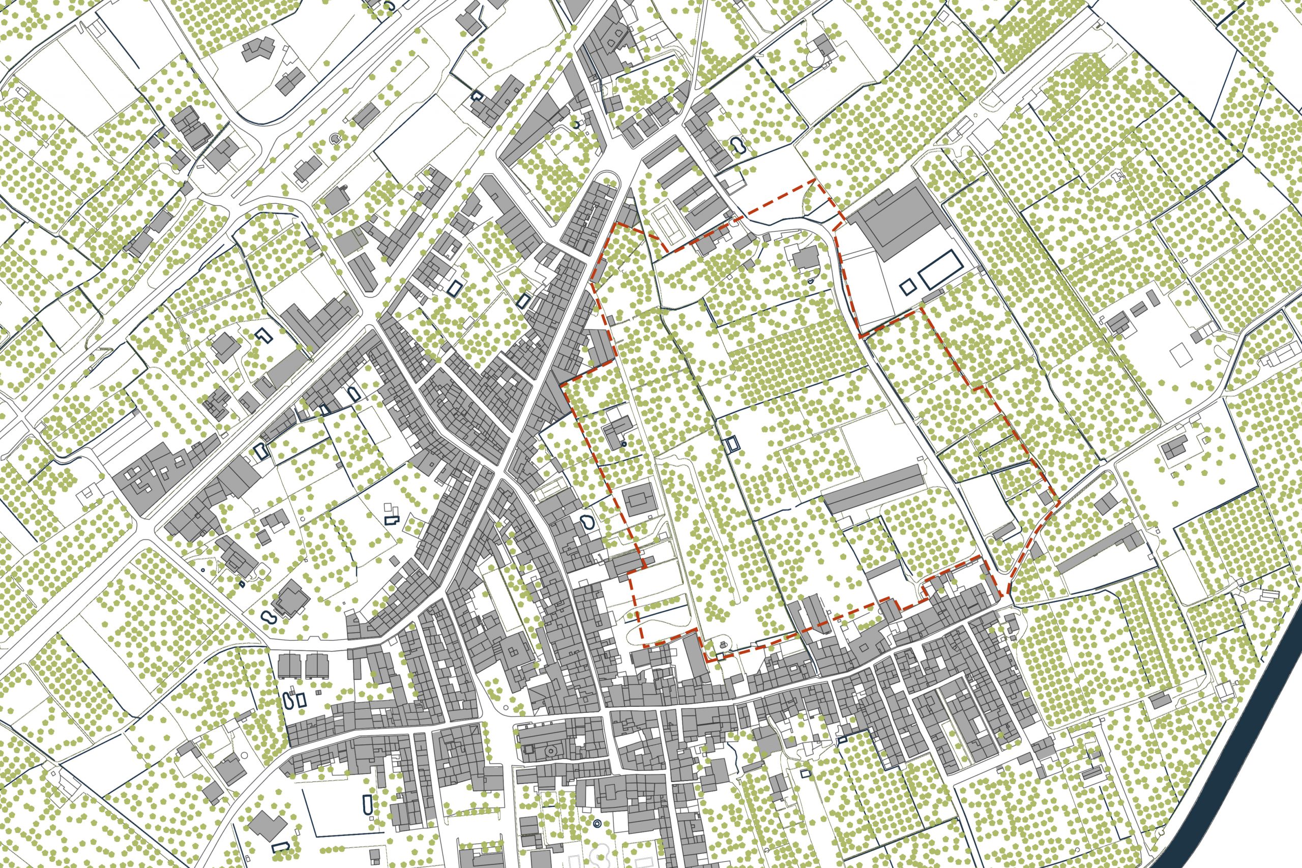
PROJECT INFORMATION
Location: Xerta (Tarragona), Spain
Scale: 58000 m2
Software: AutoCAD, Photoshop, Illustrator
DESCRIPTION
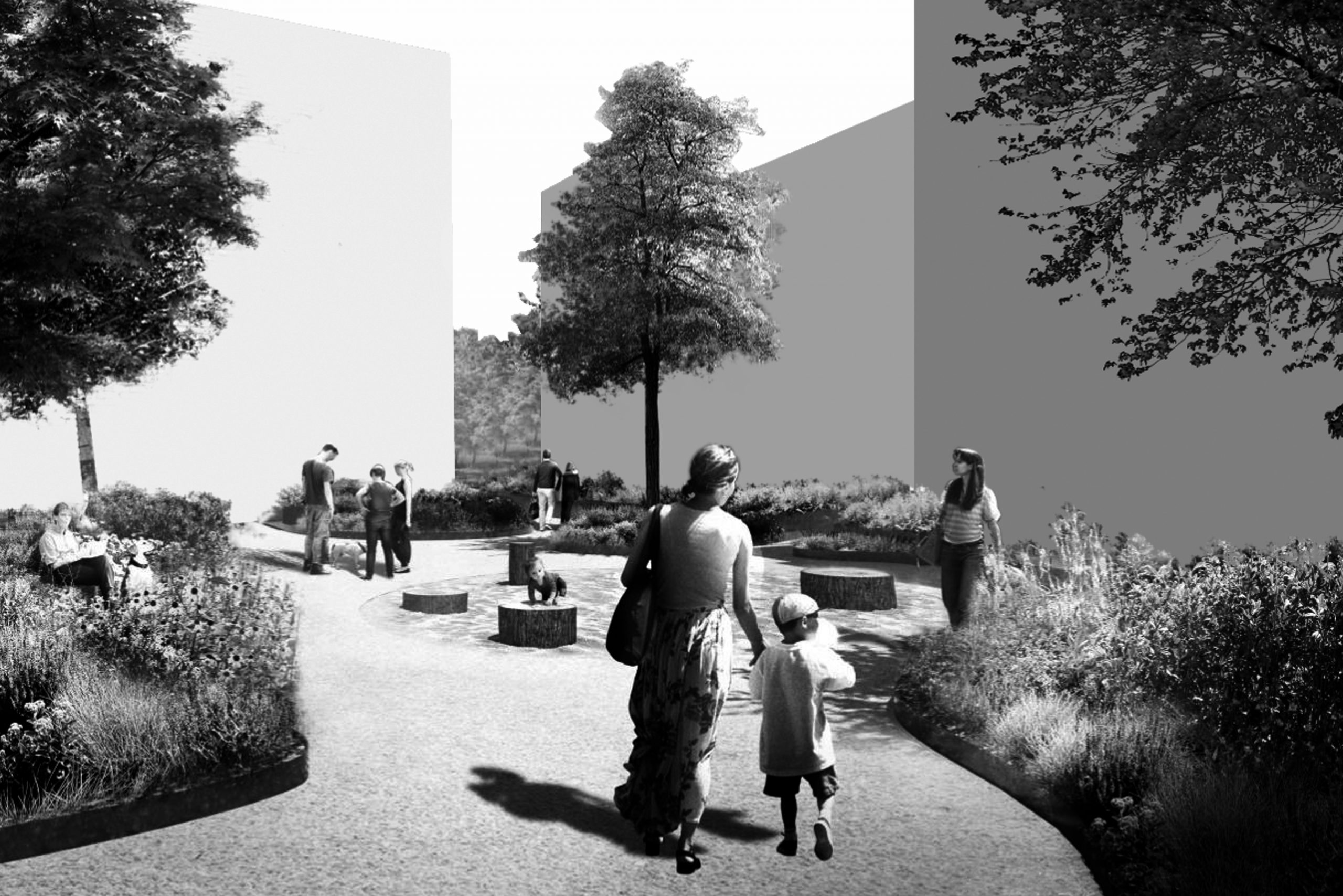
The municipality of Xerta wants to make a partial plan for the expansion of the village. The proposal for this plan consist in to create a parallel axis to the existing one (the road) following the canal. Firstly, the squares are located in areas where there was no vegetation, trying to preserve the maximum existing trees. This squares always with a facility which the legislation requires. Secondly, it is proposed two new connections with this new axis (the other axis has two existing connections to the village). One connection directly to the center and the other to an expansion area. Moreover, the housing proposed here (following the legislation) is ground floor + 3 floors (with the possibility to have an underground parking), the minimum facade is 3.5 m and the minimum plot 80 m2. With an occupancy rate of 80% and following the maximum density, which is 0.35, there only can be 202 houses (they won’t be isolated).
The proposal promotes the organic growth of the village, following the existing axis and the other through the water canal, including a transversal connection between them that solves all the circulation problem. With the squares located with their facilities and all the housing located following the existing housing, the partial plan for the people of Xerta is solved in a simple and clear way.
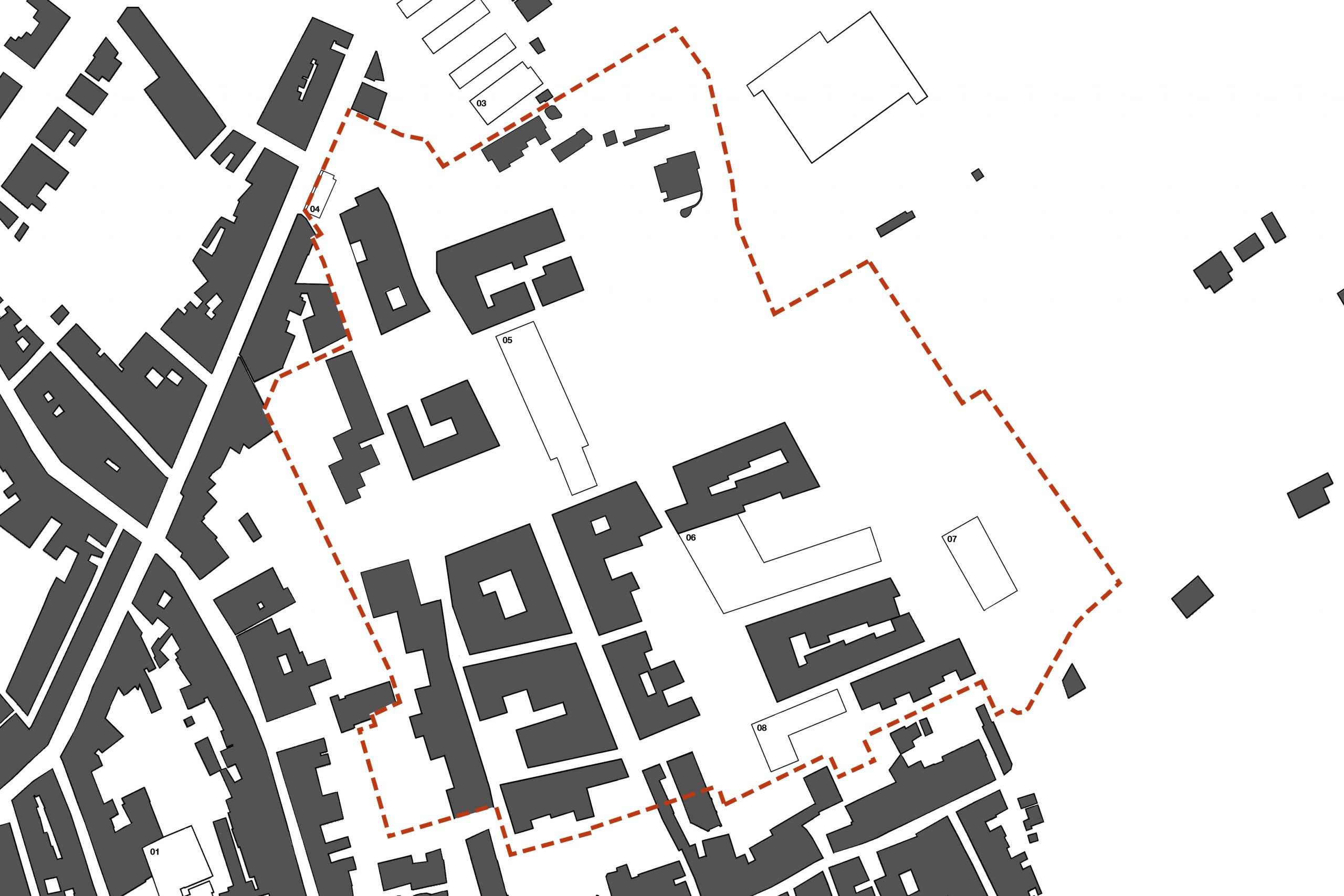
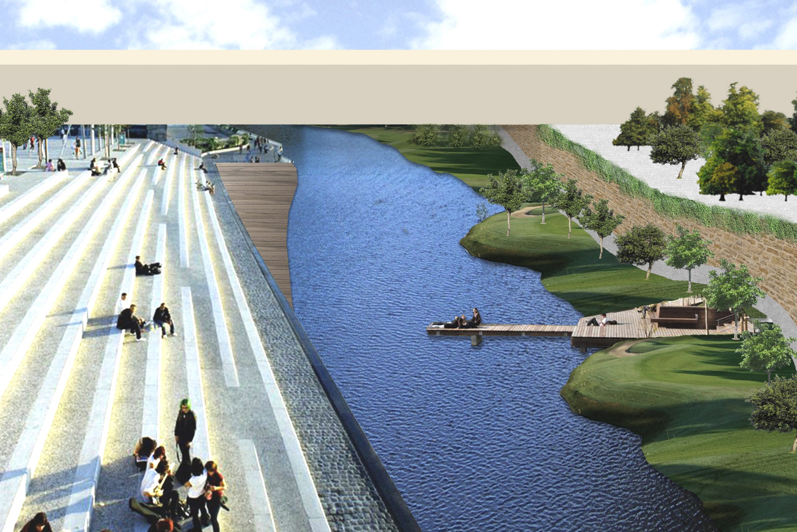
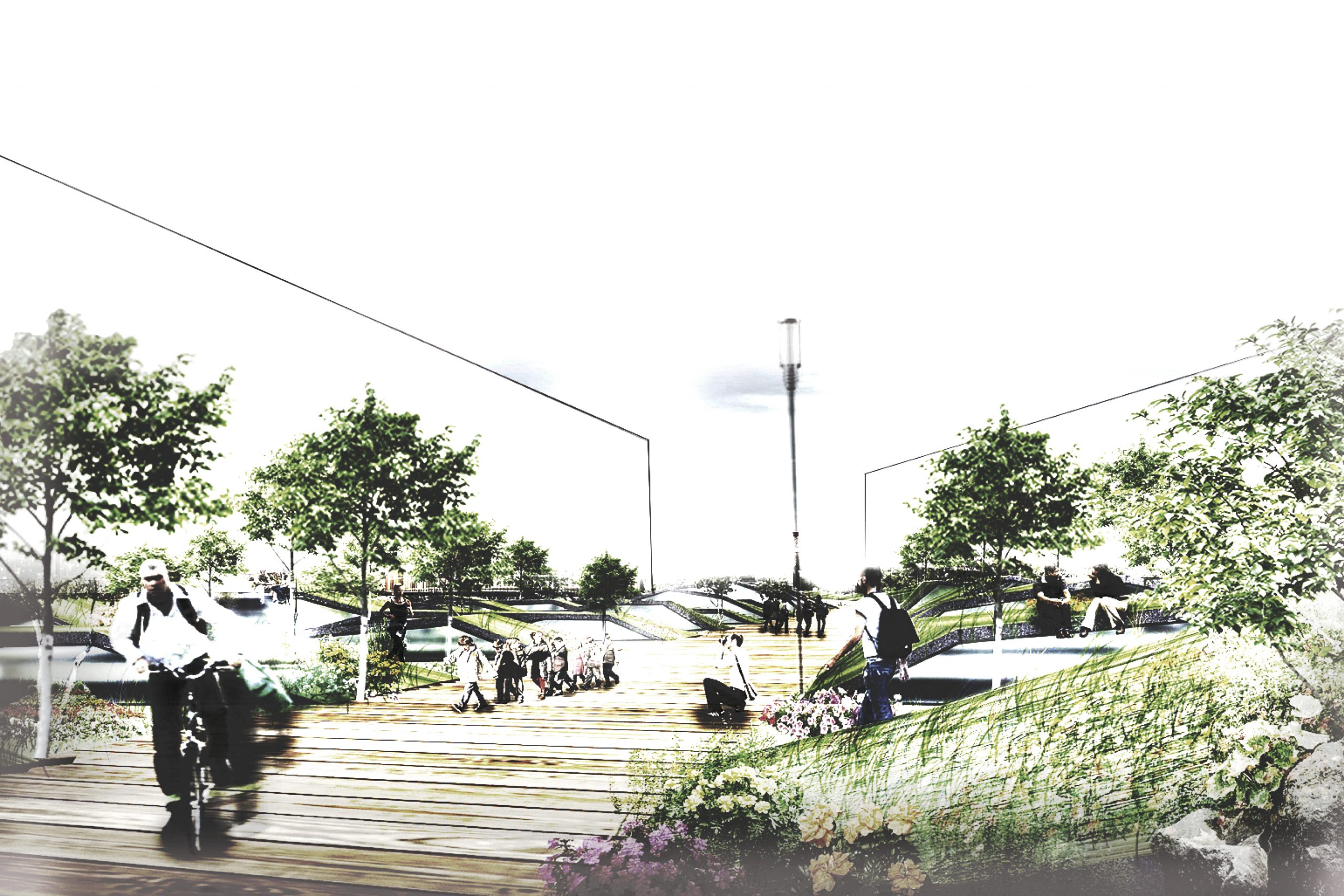
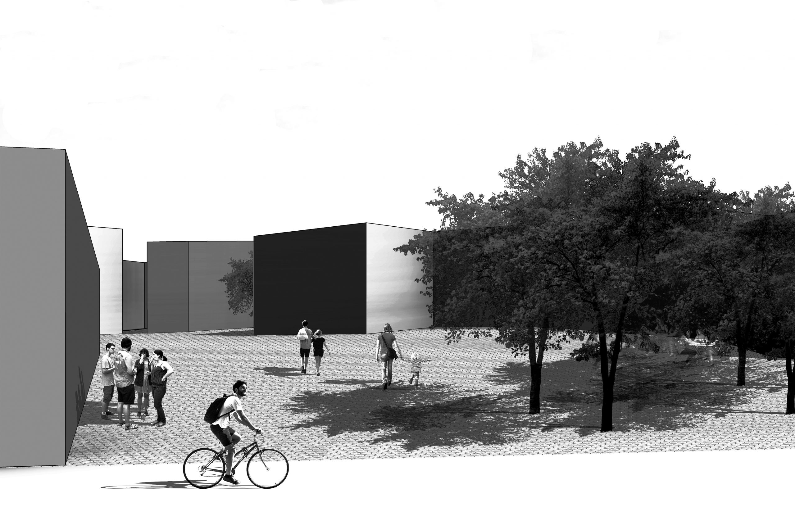
Proposal of ideas for Vic
PROJECT INFORMATION
Location: Vic (Barcelona), Spain
Scale: 25000 m2
Software: AutoCAD, Photoshop, Illustrator
DESCRIPTION
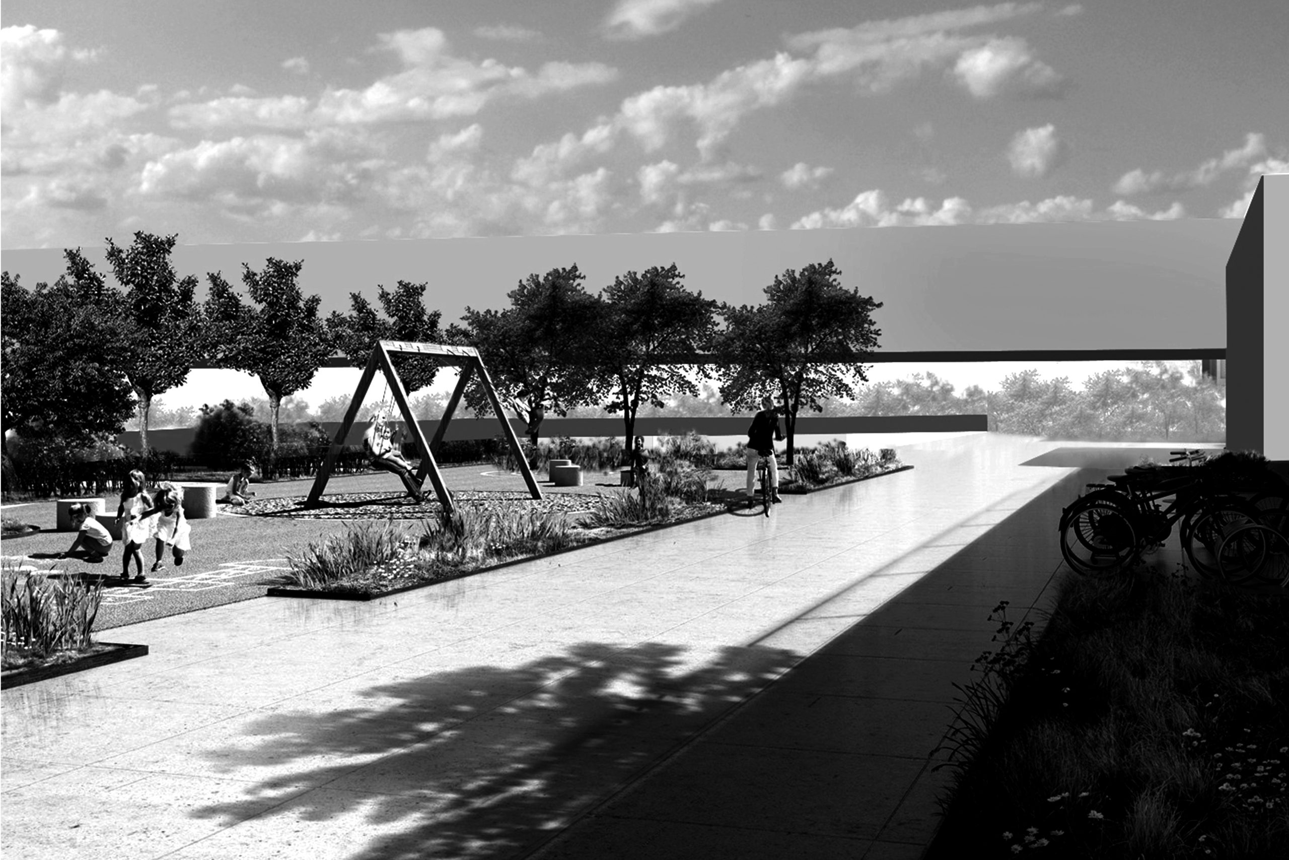
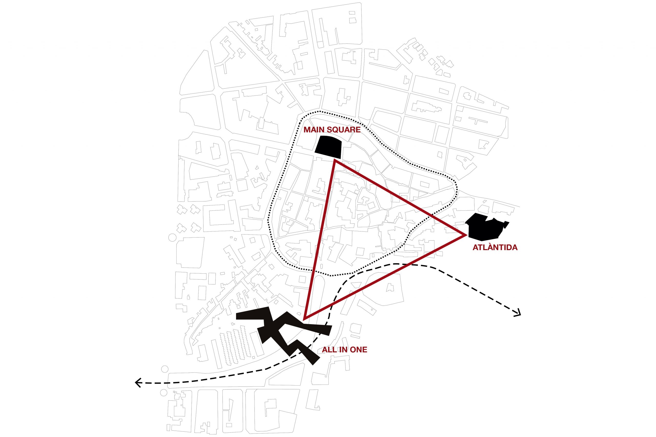
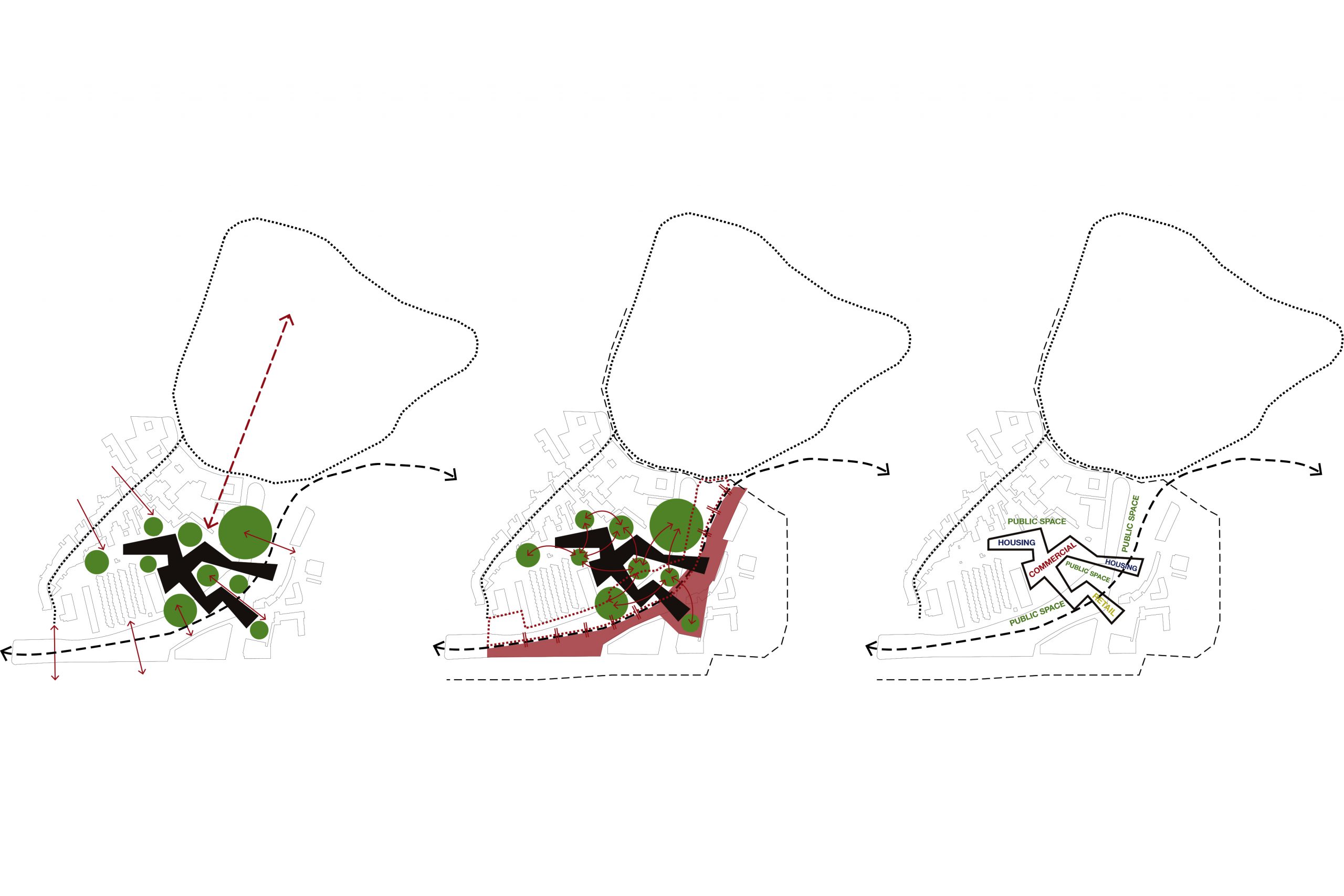
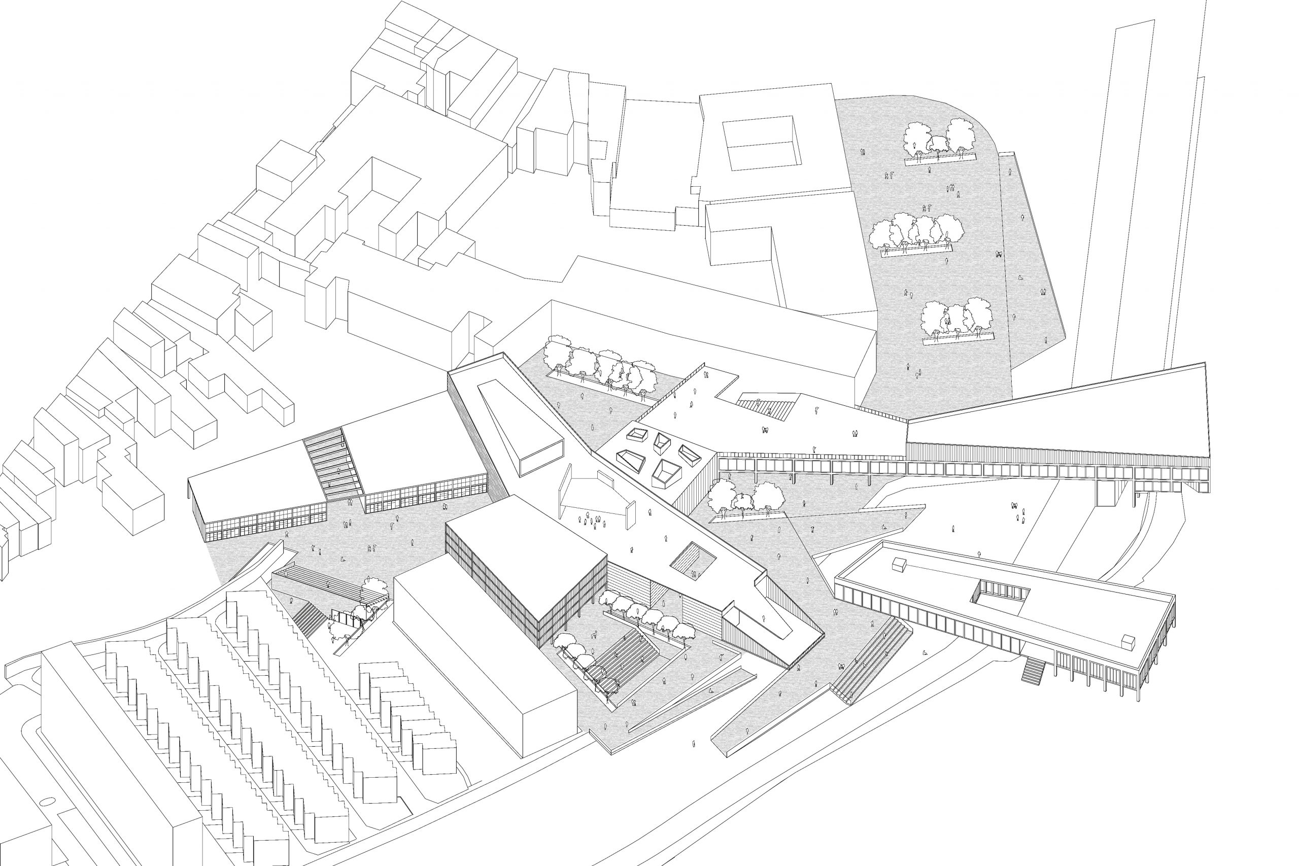
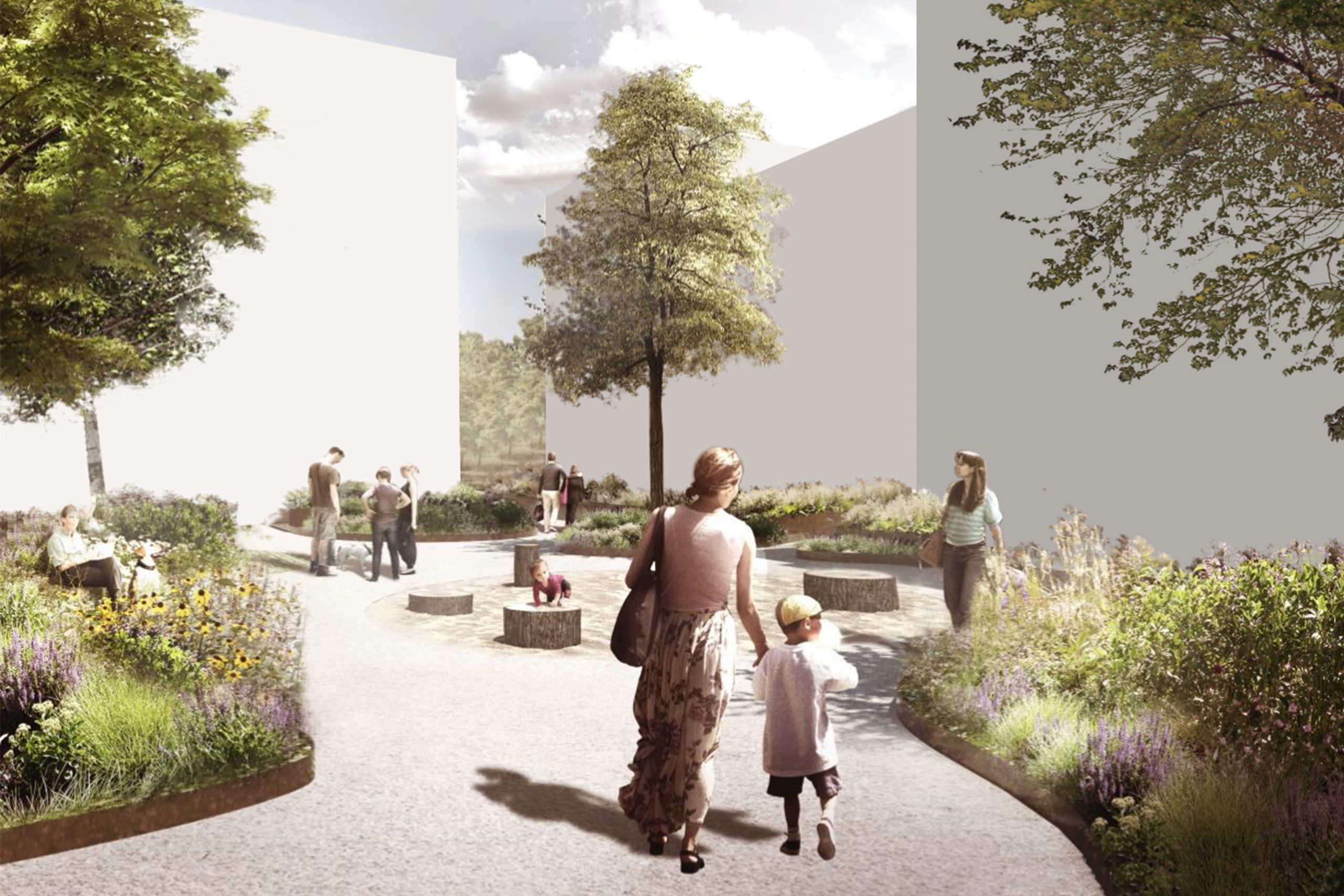
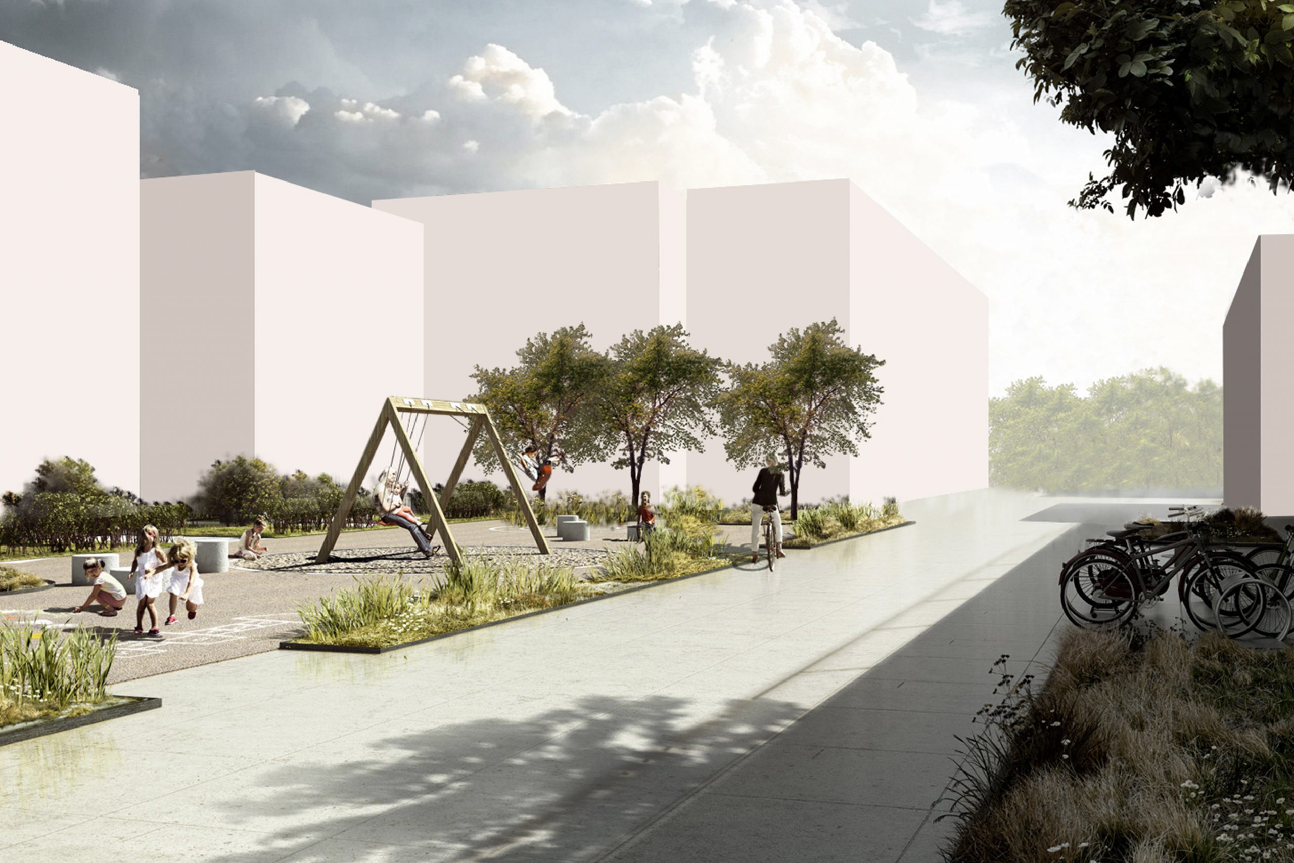
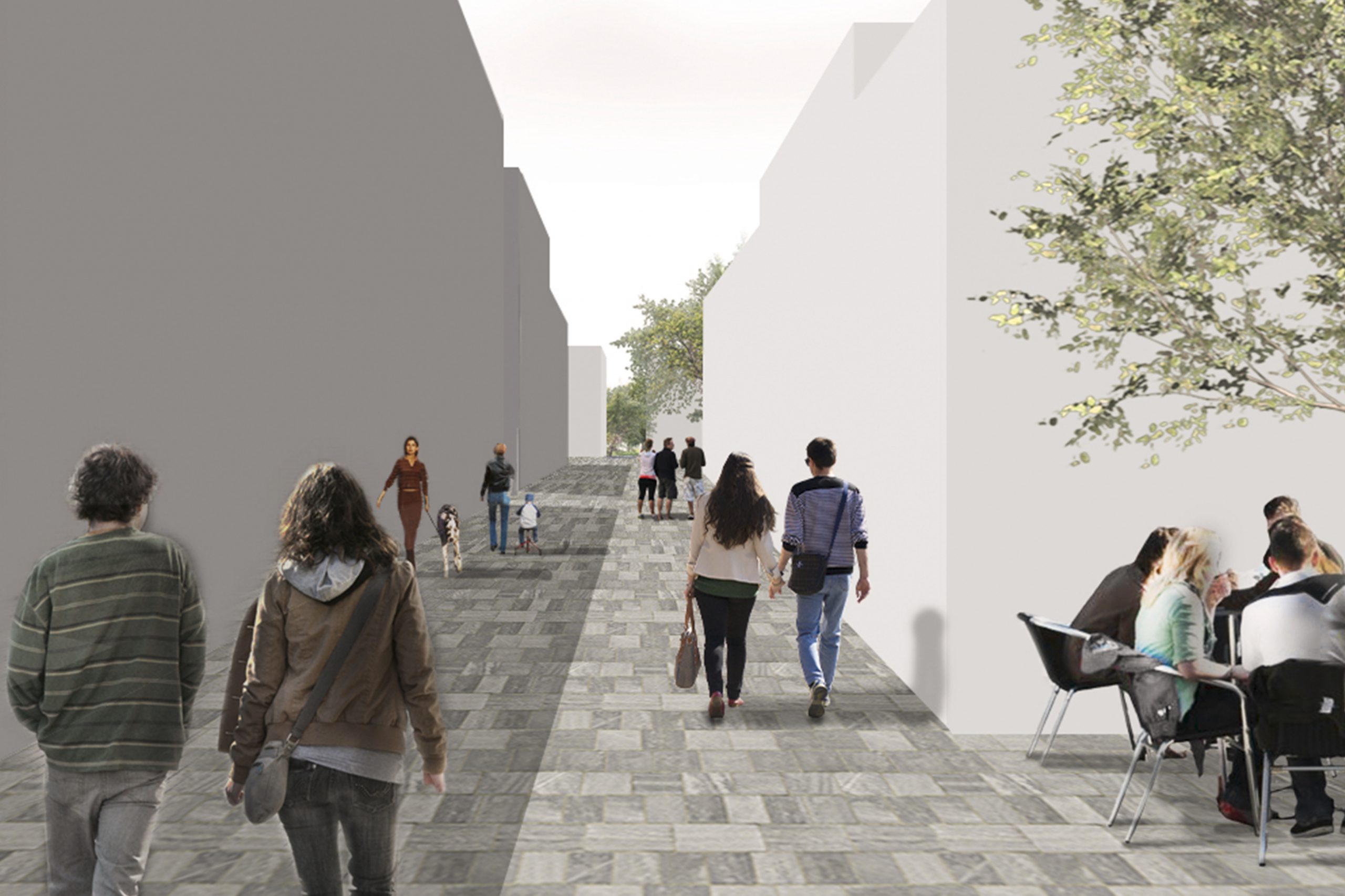
It is detected a location outside the center of Vic. From the creation of an iconic element, the intention is to interact with two pre-existing elements and to generate a cluster. This will solve the main problem of the program which the city needs in that area.
This site has a back (lined buildings) and a front (the river). Everything has a longitudinal character and the intention is to give a different rhythm, crossing the river. A dialogue is created between the public space and the volumetry generating different controlled spaces. They have the same hierarchy.
A volume is generated trying to give freedom to the nearest open spaces. They go inside the volumetry giving it a visible permeability throughout the area to work.
There is some problems of program in this area, such as recreation areas, parking, housing, etc… It is tried to solve all this program in the same volumetry, putting them all in one.
PRESENTATION
Board